New Cumberland in Hancock County, West Virginia — The American South (Appalachia)
New Cumberland
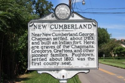
Photographed by Dale K. Benington, July 26, 2010
1. New Cumberland Marker
Erected 1975 by West Virginia Department of Archives and History.
Topics and series. This historical marker is listed in this topic list: Settlements & Settlers. In addition, it is included in the West Virginia Archives and History series list. A significant historical year for this entry is 1783.
Location. 40° 29.579′ N, 80° 36.209′ W. Marker is in New Cumberland, West Virginia, in Hancock County. It is on Ridge Avenue (West Virginia Route 2) south of Lincoln Street, on the right when traveling south. Touch for map. Marker is in this post office area: New Cumberland WV 26047, United States of America. Touch for directions.

Regionally, this marker is in the Northern Panhandle and in the High Valley. It is also in the American South, specifically in the Upper South, in the Ohio River Valley, and in Appalachia. Globally, it is in North America, the Western Hemisphere, the Western World, and
this page online
Other nearby markers. At least 8 other markers are within walking distance of this marker: New Cumberland Veterans Memorial (approx. 0.4 miles away); Propeller of M.V. (approx. 0.4 miles away); Hancock County Civil War Memorial (approx. half a mile away); Rockyside / The Black Stone Church (approx. 0.6 miles away); Gravel Hill Academy (approx. 0.6 miles away); Contested County Seat (approx. 0.6 miles away); a different marker also named Gravel Hill Academy (approx. 0.6 miles away); Captain John Porter / Chelsea China Company (approx. 0.6 miles away). Touch for a list and map of all markers in New Cumberland.
Also see . . . Welcome to New Cumberland, West Virginia. (Submitted on July 6, 2011, by Mike Wintermantel of Pittsburgh, Pennsylvania.)
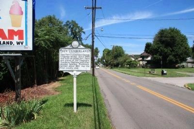
Photographed by Dale K. Benington, July 26, 2010
2. New Cumberland Marker
View of historical marker looking north along Ridge Avenue (State Route 2), from just south and across the street of the intersection of Lincoln Street.
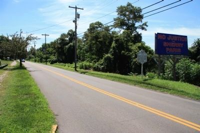
Photographed by Dale K. Benington, July 26, 2010
3. New Cumberland Marker
View of historical marker, as seen from across the street at the edge of the intersection of Lincoln Street and Ridge Avenue, looking south along Ridge Street (State Route 2).
Credits. This page was last revised on June 16, 2016. It was originally submitted on January 13, 2011, by Dale K. Benington of Toledo, Ohio. This page has been viewed 1,326 times since then and 35 times this year. Photos: 1, 2, 3. submitted on January 14, 2011, by Dale K. Benington of Toledo, Ohio.
