
South Dundas in Stormont Dundas and Glengarry United Counties, Ontario — Central Canada (North America)
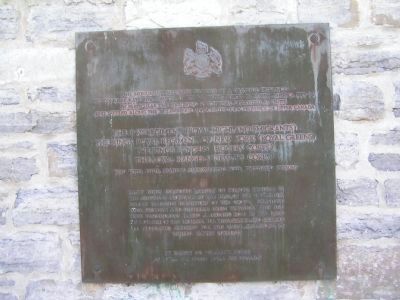
Loyalist American Regiments
⎯⎯⎯
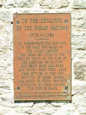
Loyalists of the Indian Nations
⎯⎯⎯
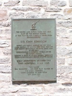
Sir John Johnson
Photographed by Nate Davidson, June 24, 2008
1. Loyalist American Regiments Marker
The 84th Regiment (Royal Highland Emigrants)
The King's Royal Regiment of New York (Royal Greens)
The King's Rangers (Rogers' Corps)
The Loyal Rangers (Jessup's Corps)
Many units composed largely of persons residing in the American Provinces at the time of the Revolution fought valiantly in support of the Crown. Forfeiting their property and suffering great privation, they and their descendants played a leading role in the rapid development of this province. For their service and sacrifice all those who suffered for this cause are known as United Empire Loyalists.
[ Rear of Monument ]
1775 - 1784
this page online
This tablet was erected on the thirtieth of June A.D. 1962 in the tenth year of reign of H.M. Elizabeth II Queen of Canada
Sir John Johnson
Died Montreal 4 Jan. 1830
was presented & the first flag raised by
Sir John Johnson
Sixth Baronet of New York
24th June 1961
Topics. This historical marker is listed in these topic lists: Patriots & Patriotism • Settlements & Settlers
Photographed by Nate Davidson, June 24, 2008
2. To the Loyalists of the Indian Nations 1775-1784
Location. 44° 56.683′ N, 75° 4.179′ W. Marker is in South Dundas, Ontario, in Stormont Dundas and Glengarry United Counties. It can be reached from Upper Canada Village south of Canada Route 2. Marker is located near the Upper Canada Village Historic Site. Touch for map. Marker is in this post office area: South Dundas ON K0C 2G0, Canada. Touch for directions.

Regionally, this marker is in Eastern Ontario. It is also in Central Canada. Globally, it is in North America, the Western Hemisphere, the Western World, and the Anglosphere. Historically, it finds itself in what was once a British colony, the Viceroyalty of New France, the Haudenosaunee (Iroquois) Confederacy, and Rupert’s Land.
Other nearby markers. At least 8 other markers are within walking distance of this marker: “The Moccasin” / « Le Moccasin » (about 120 meters away, measured in a direct line); Farran's Point / La pointe Farran (about 120 meters away); Canada's National Horse (about 180 meters away); Battle of Crysler’s Farm 1813 (about 210 meters away); Battlefield of Crysler’s Farm
Photographed by Nate Davidson, June 24, 2008
3. Sir John Johnson Marker
Photographed by Robert Rusaw, July 23, 2022
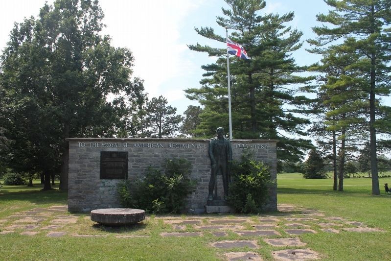
4. Loyalist American Regiments / Loyalists of the Indian Nations / Sir John Johnson Marker
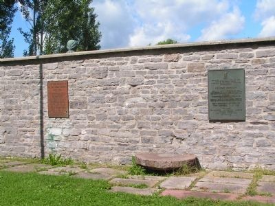
Photographed by Nate Davidson, June 24, 2008
5. Reverse side of the Loyalist American Regiments Memorial
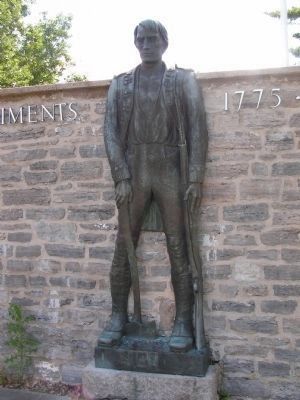
Photographed by Nate Davidson, June 24, 2008
6. Loyalist American Regiments Monument
Credits. This page was last revised on August 23, 2022. It was originally submitted on January 16, 2011, by Nathan Davidson of Salisbury, Maryland. This page has been viewed 2,485 times since then and 29 times this year. Photos: 1, 2, 3. submitted on January 16, 2011, by Nathan Davidson of Salisbury, Maryland. 4. submitted on August 1, 2022, by Robert Rusaw of Massena, New York. 5, 6. submitted on January 16, 2011, by Nathan Davidson of Salisbury, Maryland. • Syd Whittle was the editor who published this page.
