Puyallup in Pierce County, Washington — The American West (Northwest)
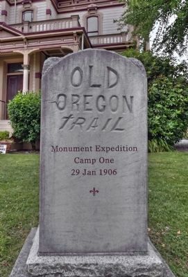
Old Oregon Trail
Photographed by Michael D Martin, August 10, 2011
1. Old Oregon Trail Marker
Front View
Front of Marker:
Camp One
29 Jan 1906
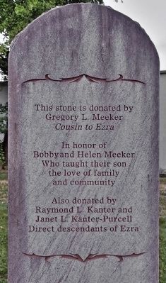
Left Side of Marker:
Gregory L. Meeker
Cousin to Ezra
In honor of Bobby and Helen Meeker who taught their son the love of family and community.
Also donated by Raymond L. Kanter and Janet L. Kanter-Purcell
Direct descendants of Ezra
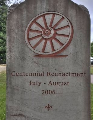
Rear of Marker:
July - August
2006
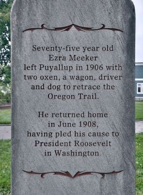
Right Side of Marker:
Seventy five year old Ezra Meeker left Puyallup in 1906 with two oxen, a wagon, driver and dog to retrace the Oregon Trail.
He returned home in June 1908, having pled his cause to President Roosevelt in Washington.
Topics and series. This historical marker is listed in these topic lists: Exploration • Settlements & Settlers. In addition, it is included in the Oregon Trail series list. A significant historical month for this entry is June 1908.
Location. 47° 11.469′ N, 122° 17.441′ W. Marker is in Puyallup, Washington, in Pierce County. It can be reached from Spring Street. Touch for map. Marker is at or near this postal address: 312 Spring Street, Puyallup WA 98372, United States of America. Touch for directions.

Regionally, this marker is in the Puget Sound Region and in Greater Seattle. It is also on the American Pacific Coast, in the Pacific Northwest, and in the Lewis & Clark Corridor. Globally, it is in North America, in the Cascade Range, in the Inside Passage, on the Ring of Fire, on the Pacific Rim, in the Western Hemisphere, in the Western World, and in the Anglosphere.
Other nearby markers. At least 8 other markers are within 8 miles of this marker, measured as the crow flies: Puyallup River Crossing (approx. 0.9 miles away); McMillin Bridge (approx. 5 miles away); South Hill Heritage Corridor (approx. 5.8 miles away); Then and Now: South End of the Thea Foss Waterway (approx.
this page online
More about this marker. Located near the front porch of the Meeker Mansion.
Also see . . .
1. Meeker Mansion web site. (Submitted on January 19, 2011, by Michael D Martin of Gig Harbor, Washington.)
2. Wikipedia entry for Ezra Meeker. (Submitted on January 19, 2011, by Michael D Martin of Gig Harbor, Washington.)
Additional keywords. Meeker, "Ezra Meeker"
Photographed by Michael D Martin, August 10, 2011
2. Old Oregon Trail Marker
There are four sides. This is the next in clockwise order.
Photographed by Michael D Martin, August 10, 2011
3. Old Oregon Trail Marker
This is the back of the marker.
Photographed by Michael D Martin, August 10, 2011
4. Old Oregon Trail Marker
This is the 4th side.
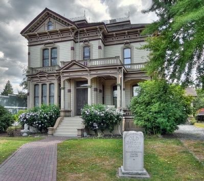
Photographed by Michael D Martin, August 26, 2010
5. Old Oregon Trail Marker
The Meeker Mansion shown in the background.
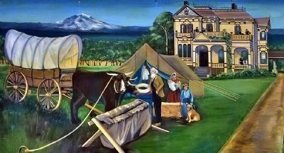
Photographed by Michael D Martin, November 30, 2009
6. Ezra Meeker Mural
At the mansion is this mural depicting the Meeker Homestead in Puyallup, Washington, ca. 1906. It features Ezra's family, mansion and Mount Rainier.
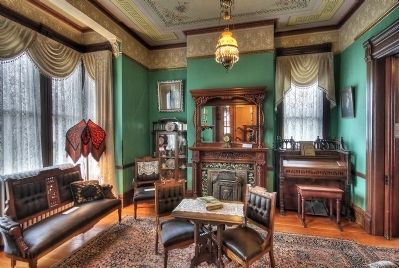
Photographed by Michael D Martin, March 1, 2009
7. Living Room, Meeker Mansion
Credits. This page was last revised on October 14, 2020. It was originally submitted on January 17, 2011, by Michael D Martin of Gig Harbor, Washington. This page has been viewed 2,676 times since then and 79 times this year. Photos: 1, 2, 3, 4. submitted on August 19, 2011, by Michael D Martin of Gig Harbor, Washington. 5, 6, 7. submitted on January 17, 2011, by Michael D Martin of Gig Harbor, Washington. • Kevin W. was the editor who published this page.
