Cayce in Lexington County, South Carolina — The American South (South Atlantic)
Battle of Congaree Creek
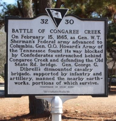
On February 15, 1865, as Gen. W.T. Sherman's Federal army advanced to Columbia, Gen. O.O. Howard's Army of the Tennessee found its way blocked by Confederates entrenched behind Congaree Creek and defending the Old State Rd. bridge. Gen. George G. Dibrell's dismounted cavalry brigade, supported by infantry and artillery, manned the nearby earthworks, portions of which survive.
(Reverse text)
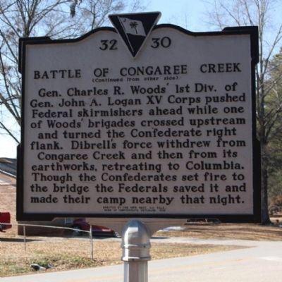
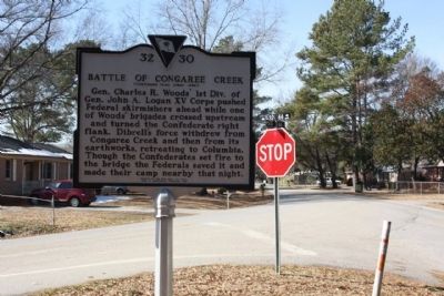
Gen. Charles R. Woods' 1st Div. of Gen. John A. Logan's XV Corps pushed Federal skirmishers ahead while one of Woods' brigades crossed upstream and turned the Confederate right flank. Dibrell's force withdrew from Congaree Creek and then from its earthworks, retreating to Columbia. Though the Confederates set fire to the bridge the Federals saved it and made their camp nearby that night.
Erected 1998 by The 15th Regt. S.C. Vols., Sons of Confederate Veterans. (Marker Number 32-30.)
Topics and series. This historical marker is listed in this topic list: War, US Civil. In addition, it is included in the Sons of Confederate Veterans/United Confederate Veterans series list. A significant historical month for this entry is February 1820.
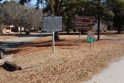
Location. 33° 57.634′ N, 81° 2.284′ W. Marker is in Cayce, South Carolina, in Lexington County. Marker is at the intersection of New State Road and Old State Road (South Carolina Highway 32-66), in the median on New State Road. Touch for map. Marker is in this post office area: Cayce SC 29033, United States of America. Touch for directions.
Other nearby markers. At least 8 other markers are within 2 miles of this marker, measured as the crow flies. Olympia Cemetery (approx. 0.8 miles away); The "Columbiad" Cannon (approx. 1.2 miles away); Mill Village Yard (approx. 1.4 miles away); Quarry - 'Rock Hole' (approx. 1.4 miles away); Mill Village Design (approx. 1.4 miles away); Olympia Mill School/Museum House (approx. 1.4 miles away); Olympia Mill School (1901-1909) / Olympia Granby Historical Foundation (approx. 1.4 miles away); Jaco's Corner (approx. 1.4 miles away).
Also see . . . Battle of Congaree Creek, Wikipedia entry. Battle of Congaree Creek * Part of the American Civil War * Date February 15, 1865 (1865-02-15) * Location Cayce, South Carolina * Result Union victory * Belligerents : United States (Union) CSA (Confederacy) * Casualties and losses 20 Union - CSA Unknown (Submitted on January 20, 2011, by Mike Stroud of Bluffton, South Carolina.)
Credits. This page was last revised on September 18, 2020. It was originally submitted on January 20, 2011, by Mike Stroud of Bluffton, South Carolina. This page has been viewed 2,715 times since then and 113 times this year. Photos: 1, 2, 3, 4. submitted on January 21, 2011, by Mike Stroud of Bluffton, South Carolina.


