Salisbury in Wicomico County, Maryland — The American Northeast (Mid-Atlantic)
Wicomico Wetlands
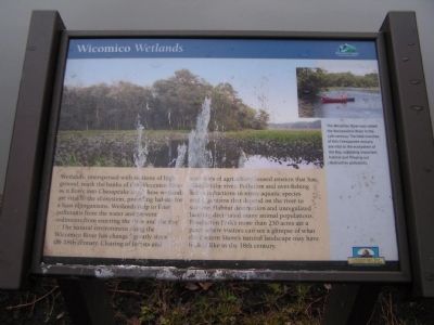
The natural environment along the Wicomico River has changed greatly since the 18th century. Clearing of forests and centuries of agriculture caused erosion that has silted in the river. Pollution and over-fishing led to reductions in many aquatic species and organisms that depend on the river to survive. Habitat destruction and unregulated hunting decimated many animal populations. Pemberton Park's more than 250 acres area place where visitors can see a glimpse of what the Eastern Shore's natural landscape may have looked like in the 18th century.
Erected by Wicomico County Parks & Tourism, Chesapeake Bay Gateways Network.
Topics. This historical marker is listed in this topic list: Environment.
Location. 38° 20.767′ N, 75° 38.717′ W. Marker is in Salisbury, Maryland, in Wicomico County. Marker can be reached from Plantation Lane, 0.6 miles south of Pemberton Drive. This marker is located within Pemberton Park. Touch for map. Marker is at or near this postal address: 5561 Plantation Lane, Salisbury MD 21801, United States of America. Touch for directions.
Other nearby markers. At least 8 other markers are within walking distance of this marker. The Original Residents (within shouting distance of this marker); An Apple a Day (within shouting distance of this marker); A Water Connection (within shouting distance of this marker); Nature's Pasture (within shouting distance of this marker); A Drop to Drink (about 400 feet away, measured in a direct line); A Show of Wealth (about 500 feet away); Pemberton Hall (about 600 feet away); The "Peculiar Institution" at Pemberton Plantation (about 700 feet away). Touch for a list and map of all markers in Salisbury.
More about this marker. On top are photos with the caption, "The Wicomico River was called the Rockawalkin River in the 17th century. The tidal marshes of this Chesapeake estuary are vital to the ecosystem of the Bay, supplying important habitat and filtering out destructive pollutants."
Also see . . . Pemberton Park. (Submitted on January 25, 2011, by Bernard Fisher of Richmond, Virginia.)
Credits. This page was last revised on June 16, 2016. It was originally submitted on January 22, 2011, by Nathan Davidson of Salisbury, Maryland. This page has been viewed 575 times since then and 21 times this year. Photos: 1, 2. submitted on January 22, 2011, by Nathan Davidson of Salisbury, Maryland. • Bernard Fisher was the editor who published this page.

