Munfordville in Hart County, Kentucky — The American South (East South Central)
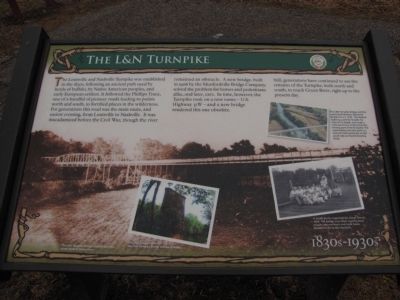
The L&N Turnpike
1830s - 1930s
Still, generations have continued to use the remains of the Turnpike, both north and south, to reach Green River, right up to the present day.
Erected by City of Munfordville.
Topics. This historical marker is listed in these topic lists: Bridges & Viaducts • Exploration • Roads & Vehicles • Settlements & Settlers. A significant historical year for this entry is 1906.
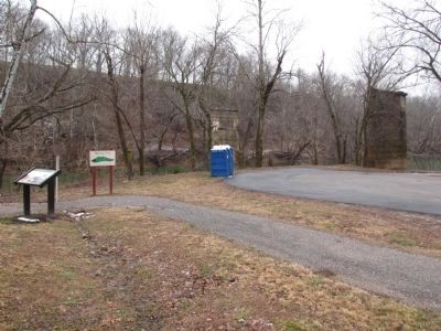
Location. 37° 16.005′ N, 85° 53.318′ W. Marker is in Munfordville, Kentucky, in Hart County. Marker is on River Road , 0.3 miles south of Old Street, on the left when traveling south. Part of a series of markers in Thelma Stovall Park highlighting the history of Munfordville, this marker is located adjacent to the Green River and the site of the L&N Turnpike bridge. Touch for map. Marker is at or near this postal address: 197 River Road, Munfordville KY 42765, United States of America. Touch for directions.
Other nearby markers. At least 8 other markers are within walking distance of this marker. The Great Buffalo Crossing (within shouting distance of this marker); Pontooniers! (about 300 feet away, measured in a direct line); Amos' Ferry (about 700 feet away); Return of the Natives (approx. ¼ mile away); L&N Railroad Bridge (approx. ¼ mile away); Thelma Hawkins Stovall (approx. ¼ mile away); Old Munford Inn (approx. ¼ mile away); Stanley W. Cottrell Jr (approx. 0.3 miles away). Touch for a list and map of all markers in Munfordville.
More about this marker. The background image is a photo of "The L&N Turnpike Bridge, viewed from the south bank of Green River."
On the lower left is a photo of the bridge site with the caption,"The main support piers for the L&N Turnpike Bridge still stand today."
On the lower right is a photo with the caption,"A youth picnic organized by a local church, 1929. The bridge was often used by local people to travel back and forth from Woodsonville to Munfordville."

Photographed By Lee Hattabaugh, January 25, 2011
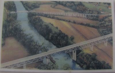
3. The L&N Turnpike Bridge and the Buckner Memorial Bridge.
The L&N Turnpike Bridge and the newly-built Buckner Memorial Bridge for U.S. 31W. The federal highway used the Turnpike for most of its length, but made a wide bend here at Munfordville, leaving part of the Turnpike. The road leading into this park is a remnant that continues on the south side as Charlie Downing Road.
Credits. This page was last revised on June 16, 2016. It was originally submitted on February 2, 2011, by Lee Hattabaugh of Capshaw, Alabama. This page has been viewed 1,405 times since then and 63 times this year. Photos: 1, 2, 3. submitted on February 2, 2011, by Lee Hattabaugh of Capshaw, Alabama. • Bernard Fisher was the editor who published this page.

