Munfordville in Hart County, Kentucky — The American South (East South Central)
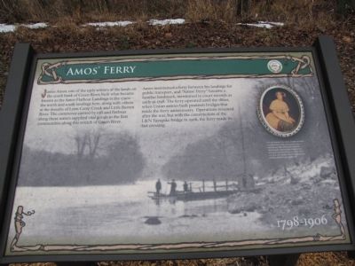
Amos' Ferry
1798 - 1906
Amos maintained a ferry between his landings for public transport, and "Amos' Ferry" became a familiar landmark, mentioned in court records as early as 1798. The ferry operated until the 1860s, when Union armies built pontoon bridges that made the ferry unnecessary. Operations resumed after the war, but with the construction of the L&N Turnpike bridge in 1906, the ferry made its last crossing.
Erected by City of Munfordville.
Topics. This historical marker is listed in these topic lists: Bridges & Viaducts • Industry & Commerce • Settlements & Settlers • War, US Civil. A significant historical year for this entry is 1798.
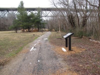
Location. 37° 16.082′ N, 85° 53.21′ W. Marker is in Munfordville, Kentucky, in Hart County. Marker can be reached from River Road east of Old Street, on the left when traveling south. Part of a series of markers in Thelma Stovall Park highlighting the history of Munfordville, this marker is situated on the walking track that circles the park. Touch for map. Marker is in this post office area: Munfordville KY 42765, United States of America. Touch for directions.
Other nearby markers. At least 8 other markers are within walking distance of this marker. Pontooniers! (about 400 feet away, measured in a direct line); Return of the Natives (about 500 feet away); The Great Buffalo Crossing (about 500 feet away); L&N Railroad Bridge (about 700 feet away); The L&N Turnpike (about 700 feet away); Living on the Land (approx. 0.2 miles away); The Pump Tower (approx. 0.2 miles away); Old Munford Inn (approx. 0.2 miles away). Touch for a list and map of all markers in Munfordville.

Photographed By Lee Hattabaugh, January 25, 2011
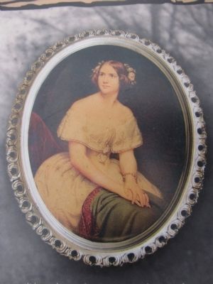
3. Jenny Lind
It is not known how many people crossed on Amos' Ferry, but among the more famous was the celebrated "Swedish Nightingale", opera singer Jenny Lind, during her American tour in 1854. After crossing, she stopped for the night at the Old Munford Inn just up the hill.
Note - See HMDB marker 39989 for more information on the Inn
Note - See HMDB marker 39989 for more information on the Inn
Credits. This page was last revised on June 16, 2016. It was originally submitted on February 2, 2011, by Lee Hattabaugh of Capshaw, Alabama. This page has been viewed 1,010 times since then and 33 times this year. Photos: 1, 2, 3. submitted on February 2, 2011, by Lee Hattabaugh of Capshaw, Alabama. • Craig Swain was the editor who published this page.

