Marysville in Yuba County, California — The American West (Pacific Coastal)
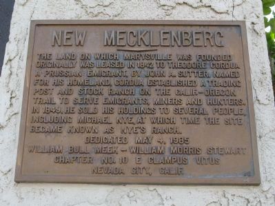
New Mecklenberg
Erected 1985 by William Bull Meek, Chapter 10 E Clampus Vitus.
Topics and series. This historical marker is listed in this topic list: Settlements & Settlers. In addition, it is included in the E Clampus Vitus series list. A significant historical year for this entry is 1842.
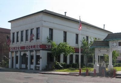
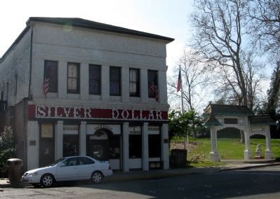
Location. 39° 8.158′ N, 121° 35.296′ W. Marker is in Marysville, California, in Yuba County. Marker is at the intersection of 1st Street and D Street, on the right when traveling east on 1st Street. Marker is mounted on the front of the Silver Dollar Saloon. Touch for map. Marker is at or near this postal address: 330 1st Street, Marysville CA 95901, United States of America. Touch for directions.
Other nearby markers. At least 8 other markers are within walking distance of this marker. Lord Sholto Douglas (a few steps from this marker); Historical Monument of Macy’s (within shouting distance of this marker); Bok Kai Temple (within shouting distance of this marker); Davis Hotel (within shouting distance of this marker); Chinese Rock Wall (within shouting distance of this marker); Mission Building (within shouting distance of this marker); Beckwourth Trail – Marysville (approx. 0.2 miles away); José Manuel Ramírez Rosales (approx. 0.3 miles away). Touch for a list and map of all markers in Marysville.
Also see . . . Marysville, California. Wikipedia entry (Submitted on October 26, 2020, by Larry Gertner of New York, New York.)
Credits. This page was last revised on October 26, 2020. It was originally submitted on February 7, 2011, by Syd Whittle of Mesa, Arizona. This page has been viewed 796 times since then and 15 times this year. Photos: 1, 2, 3. submitted on February 7, 2011, by Syd Whittle of Mesa, Arizona.


