Browns Valley in Yuba County, California — The American West (Pacific Coastal)
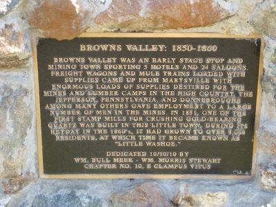
Browns Valley: 1850 – 1860
Erected 2010 by Wm. Bull Meek - Wm. Morris Stewart Chapter No. 10, E Clampus Vitus.
Topics and series. This historical marker is listed in this topic list: Settlements & Settlers. In addition, it is included in the E Clampus Vitus series list. A significant historical year for this entry is 1851.
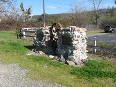
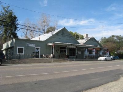
Location. 39° 14.41′ N, 121° 24.547′ W. Marker is in Browns Valley, California, in Yuba County. Marker is on Marysville Road, one mile north of California Highway 20. Marker is located in front of the Browns Valley Post Office. Touch for map. Marker is at or near this postal address: 5538 Marysville Road, Browns Valley CA 95918, United States of America. Touch for directions.
Other nearby markers. At least 8 other markers are within 7 miles of this marker , measured as the crow flies. Brown's Valley: Beginnings (here, next to this marker); Donnebrouge Mine (about 700 feet away, measured in a direct line); Hammon Grove (approx. 0.9 miles away); The Yuba River Bridge at Parks Bar (approx. 4.3 miles away); Loma Rica Grange Hall #802 (approx. 5 miles away); Sucker Flat (approx. 6.2 miles away); Church of the Immaculate Conception (approx. 6.4 miles away); Smartville / Smartsville (approx. 6.4 miles away). Touch for a list and map of all markers in Browns Valley.
Regarding Browns Valley: 1850 – 1860. Browns Valley is located about thirteen miles northwest of Marysville on the old road to Downieville. It now is located one mile north of State Highway 20 on Marysville Road. An early settler named Brown, who came to the area in 1850, discovered gold near a huge bolder next to the temporary camp where he was living. After finding over $12,000 in gold he decided that he had earned enough and “was satisfied to retire.” Soon after his find, four Frenchmen developed the Jefferson Mine. This was followed by the development of several additional mines. One of first stamp mills was erected at the nearby Sweet Vengeance Mine which had been purchased by a French company from Spaniards who had been working the Little Dry Creek using the arrastra method.
Also see . . .
Arrastra Mining Technique. A mule, or the miners themselves, pulled the boom around the circle, dragging heavy stones over the quartz ore to crush it. The miners then separated the gold from the pulverized ore in wooden bowls called bateas. (Submitted on February 8, 2011.)
Additional keywords. Gold Rush
Credits. This page was last revised on June 16, 2016. It was originally submitted on February 8, 2011, by Syd Whittle of Mesa, Arizona. This page has been viewed 1,490 times since then and 52 times this year. Photos: 1, 2, 3. submitted on February 8, 2011, by Syd Whittle of Mesa, Arizona.


