Near Page in Coconino County, Arizona — The American Mountains (Southwest)
Dinosaur Tracks
Photographed by William Fischer, Jr., November 13, 2010
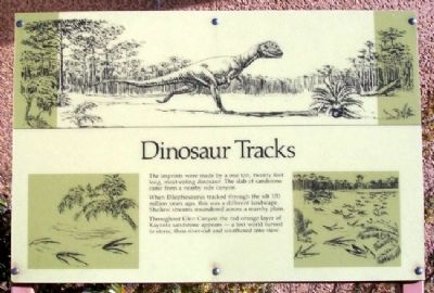
1. Dinosaur Tracks Marker
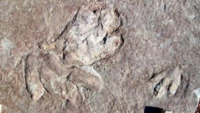
The imprints were made by a one ton, twenty foot long, meat-eating dinosaur. The slab of sandstone came from a nearby side canyon.
When Dilophosaurus tracked through the silt 170 million years ago, this was a different landscape. Shallow streams meandered across a marshy plain.
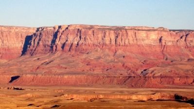
Throughout Glen Canyon the red-orange layer of Kayenta sandstone appears - a lost world turned to stone, then river-cut and weathered into view.
Erected by National Park Service.
Topics. This historical marker is listed in this topic list: Paleontology.
Location. 36° 56.138′ N, 111° 29.153′ W. Marker is near Page, Arizona, in Coconino County. It can be reached from U.S. 89. Marker is at the Carl Hayden Visitor Center at Glen Canyon Dam, off US Route 89 at the Colorado River. Touch for map. Marker is in this post office area: Page AZ 86040, United States of America. Touch for directions.

Regionally, this marker is in Flagstaff & High Country, in the Navajo Nation, and in Hopi. It is also in the American Southwest, in the Mountain West, on the Colorado Plateau, and at the Four Corners.
this page online
Other nearby markers. At least 8 other markers are within walking distance of this marker: Bureau of Reclamation Memorial Fountain (within shouting distance of this marker); Lake Powell (within shouting distance of this marker); Concrete Bucket / Concrete Core Sample (about 300 feet away, measured in a direct line); Turbine Runner (about 300 feet away); Wicket Gates (about 300 feet away); Hydroelectric Power - A Green and Renewable Energy Source (about 400 feet away); Rock Bolts / High Scaling (about 400 feet away); Major John Wesley Powell (about 500 feet away). Touch for a list and map of all markers in Page.
Also see . . .
1. Jurassic. Wikipedia entry (Submitted on January 2, 2021, by Larry Gertner of New York, New York.)
2. Kayenta Formation. Wikipedia entry (Submitted on February 16, 2011, by William Fischer, Jr. of Reynoldsburg, Ohio.)
3. Glen Canyon National Recreation Area. National Park Service
Photographed by William Fischer, Jr., November 13, 2010
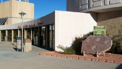
2. Dinosaur Tracks and Marker
Photographed by William Fischer, Jr., November 13, 2010
3. Dinosaur Tracks
Photographed by William Fischer, Jr., November 13, 2010
4. Land Formation South of Glen Canyon Dam
Credits. This page was last revised on May 27, 2023. It was originally submitted on February 16, 2011, by William Fischer, Jr. of Reynoldsburg, Ohio. This page has been viewed 2,239 times since then and 55 times this year. Photos: 1, 2, 3, 4. submitted on February 16, 2011, by William Fischer, Jr. of Reynoldsburg, Ohio.
