Ruckersville in Greene County, Virginia — The American South (Mid-Atlantic)
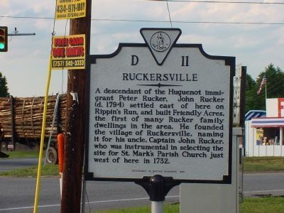
Ruckersville
Erected 1990 by Department of Historic Resources. (Marker Number D-11.)
Topics and series. This historical marker is listed in this topic list: Settlements & Settlers. In addition, it is included in the Virginia Department of Historic Resources (DHR) series list. A significant historical year for this entry is 1732.
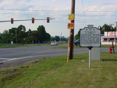
Location. 38° 13.98′ N, 78° 22.164′ W. Marker is in Ruckersville, Virginia, in Greene County. Marker is at the intersection of Seminole Trail (U.S. 29) and Spotswood Trail (U.S. 33) when traveling west on Seminole Trail. Touch for map. Marker is in this post office area: Ruckersville VA 22968, United States of America. Touch for directions.
Other nearby markers. At least 8 other markers are within 7 miles of this marker, measured as the crow flies. The Taylor House (approx. 0.2 miles away); Orange County / Greene County (approx. 1.9 miles away); Greene County / Madison County (approx. 3˝ miles away); Advance Mills (approx. 5.1 miles away); Stanardsville (approx. 5.8 miles away); Barboursville (approx. 6.6 miles away); Governor James Barbour (approx. 6.6 miles away); Cavalry Engagement at Jack’s Shop (approx. 6.6 miles away). Touch for a list and map of all markers in Ruckersville.
Credits. This page was last revised on June 10, 2021. It was originally submitted on December 7, 2007, by J. J. Prats of Powell, Ohio. This page has been viewed 3,359 times since then and 859 times this year. Photos: 1, 2, 3. submitted on December 7, 2007, by J. J. Prats of Powell, Ohio.


