Franklin Park in Allegheny County, Pennsylvania — The American Northeast (Mid-Atlantic)
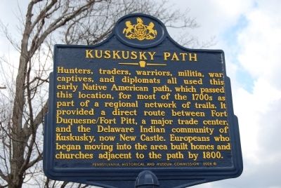
Kuskusky Path
Hunters, traders, warriors, militia, war captives, and diplomats all used this early Native American path, which passed this location, for most of the 1700s as part of a regional network of trails. It provided a direct route between Fort Duquesne/Fort Pitt, a major trade center, and the Delaware Indian community of Kuskusky, now New Castle. Europeans who began moving into the area built homes and churches adjacent to the path by 1800.
Erected 2008 by Pennsylvania Historical and Museum Commission.
Topics and series. This historical marker is listed in these topic lists: Native Americans • Settlements & Settlers. In addition, it is included in the Pennsylvania Historical and Museum Commission series list. A significant historical year for this entry is 1800.
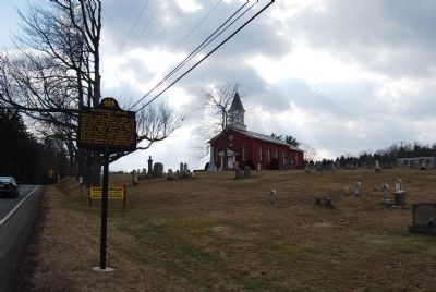
Location. 40° 36.119′ N, 80° 4.826′ W. Marker is in Franklin Park, Pennsylvania, in Allegheny County. Marker is on Brandt School Road, on the right when traveling south. Marker is located next to the Trinity Evangelical Lutheran Church Cemetery. Touch for map. Marker is at or near this postal address: 2501 Brandt School Rd, Wexford PA 15090, United States of America. Touch for directions.
Other nearby markers. At least 8 other markers are within 4 miles of this marker, measured as the crow flies. Trinity German Evangelical Lutheran Church (within shouting distance of this marker); Stone Mansion (approx. 1.4 miles away); a different marker also named Stone Mansion (approx. 1.4 miles away); Jonas Salk (approx. 1.7 miles away); Herb Scott (approx. 1.8 miles away); Borough of Bradford Woods (approx. 2˝ miles away); In Memory of Eric S. Holman, Staff Sergeant, U.S. Army (approx. 3.3 miles away); Mt. Nebo U.P. Church War Memorial (approx. 3.6 miles away). Touch for a list and map of all markers in Franklin Park.
Also see . . . Kuskusky Path - Behind the Marker. Explore PA History website entry (Submitted on July 7, 2011, by Mike Wintermantel of Pittsburgh, Pennsylvania.)

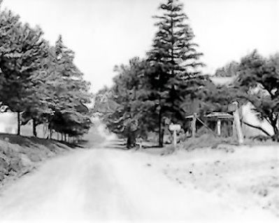
Photographed By Unknown, circa 1930
3. Brandt School Road, Franklin Park, Allegheny County, PA
Located east of Route 79, which links Pittsburgh to Erie, Brandt School Road was built over the Kuskusky Path through Franklin Park.Trinity Lutheran Cemetery is on the left side of this section of the road, not far below the old one-room Brandt School, now a private residence at the entrance to the Northmont Farms subdivision.
Courtesy of Franklin Park Borough History Collection, Allegheny County, PA
Credits. This page was last revised on September 2, 2022. It was originally submitted on February 18, 2011, by Mike Wintermantel of Pittsburgh, Pennsylvania. This page has been viewed 1,536 times since then and 77 times this year. Photos: 1, 2. submitted on February 18, 2011, by Mike Wintermantel of Pittsburgh, Pennsylvania. 3. submitted on July 26, 2011, by Mike Wintermantel of Pittsburgh, Pennsylvania. • Bernard Fisher was the editor who published this page.

