Taylors Island in Dorchester County, Maryland — The American Northeast (Mid-Atlantic)
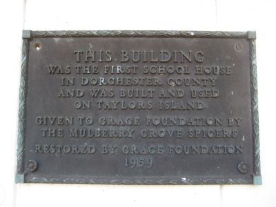
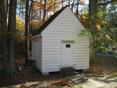
First School House
Topics. This historical marker is listed in this topic list: Education. A significant historical year for this entry is 1959.
Location. 38° 28.245′ N, 76° 18.532′ W. Marker is on Taylors Island, Maryland, in Dorchester County. Marker is on Hoopers Neck Road, 0.6 miles north of Taylors Island Road (Route 16), on the right when traveling north. Marker is attached to the school house. Touch for map. Marker is in this post office area: Taylors Island MD 21669, United States of America. Touch for directions.
Other nearby markers. At least 8 other markers are within walking distance of this marker. Chapel of Ease (a few steps from this marker); Old Schoolhouse (a few steps from this marker); Grace Episcopal Church (within shouting distance of this marker); a different marker also named Chapel of Ease (within shouting distance of this marker); Trapped (approx. 0.8 miles away); The Becky Phipps (approx. 0.8 miles away); Battle of the Ice Mound (approx. 0.8 miles away); Bethlehem Methodist Episcopal Church (approx. 0.9 miles away). Touch for a list and map of all markers in Taylors Island.
Credits. This page was last revised on May 3, 2018. It was originally submitted on December 8, 2007, by F. Robby of Baltimore, Maryland. This page has been viewed 1,221 times since then and 12 times this year. Photos: 1, 2. submitted on December 8, 2007, by F. Robby of Baltimore, Maryland.

