Red Bluff in Tehama County, California — The American West (Pacific Coastal)
St. Peter's Episcopal Church
Photographed by Andrew Ruppenstein, May 29, 2010
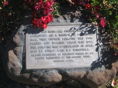
1. St. Peter's Episcopal Church Marker
The marker is mounted on a low stone on the lawn to the right of the sidewalk leading to the entrance of the church.
St. Peter's Episcopal Church formally organized as a mission in December 1888, this church building was completed and worship began May 1892. The building was consecrated in April 1895 by Bishop John H.D. Wingfield.
Plaque presented by Berendos Parlor No. 23,
Native Daughters of the Golden West
Erected 1992 by Native Daughters of the Golden West, Berendos Parlor No. 23.
Topics and series. This historical marker is listed in this topic list: Religion & Religious Structures. In addition, it is included in the Native Sons/Daughters of the Golden West series list. A significant historical month for this entry is April 1895.
Location. 40° 10.494′ N, 122° 14.122′ W. Marker is in Red Bluff, California, in Tehama County. It is at the intersection of Jefferson Street and Elm Street, on the right when traveling north on Jefferson Street. Touch for map. Marker is at or near this postal address: 510 Jefferson Street, Red Bluff CA 96080, United States of America. Touch for directions.

Regionally, this marker is in the Sacramento Valley, specifically in the Central Valley, in the Shasta Cascade, and on the Coast
this page online
Other nearby markers. At least 8 other markers are within 2 miles of this marker, measured as the crow flies: In Memory - Ken Carlson (about 400 feet away, measured in a direct line); I.O.O.F. Odd Fellows Lodge No. 76 (about 500 feet away); Tehama County World War I Memorial (about 700 feet away); Moore's Blacksmith Shop (approx. 0.2 miles away); Cone & Kimball Building Clock Tower Bell (approx. ¼ mile away); The First Christian Church (approx. 0.3 miles away); William B. Ide Adobe (approx. one mile away); a different marker also named William B. Ide Adobe (approx. 1½ miles away). Touch for a list and map of all markers in Red Bluff.
Photographed by Andrew Ruppenstein, May 29, 2010
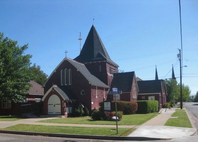
2. St. Peter's Episcopal Church (1892) and Marker
The church was designed by noted Bay Area architect Ernest Coxhead.
Credits. This page was last revised on April 3, 2022. It was originally submitted on February 23, 2011, by Andrew Ruppenstein of Lamorinda, California. This page has been viewed 787 times since then and 22 times this year. Photos: 1, 2. submitted on February 23, 2011, by Andrew Ruppenstein of Lamorinda, California. • Syd Whittle was the editor who published this page.
