Manahawkin in Stafford Township in Ocean County, New Jersey — The American Northeast (Mid-Atlantic)
Manahawkin Skirmish
December 1781
— 1776 - 1781 —
Inscription.
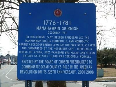
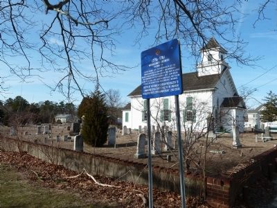
On this ground, Capt. Reuben Randolph led the Manahawkin militia (Company 5, 2nd Monmouth) against a force of British loyalists that was twice as large and commanded by the notorious Capt. John Bacon. During the action, Lines Pangborn was killed, and fellow patriot Sylvester Tilton was seriously wounded
Erected by the Board of Chosen Freeholders to commemorate Ocean County’s role in the American Revolution on its 225th anniversary, 2001-2008
Erected 2001 by Board of Chosen Freeholders.
Topics. This historical marker is listed in these topic lists: Patriots & Patriotism • War, US Revolutionary. A significant historical month for this entry is December 1781.
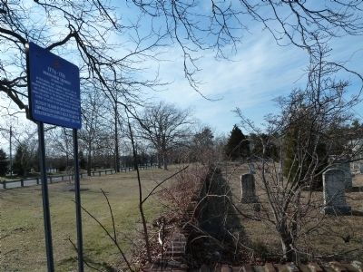
Location. 39° 41.902′ N, 74° 15.454′ W. Marker is in Stafford Township, New Jersey, in Ocean County. It is in Manahawkin. Marker is at the intersection of North Main Street (U.S. 9) and North Lakeshore Drive, on the right when traveling south on North Main Street. Touch for map. Marker is at or near this postal address: 120 Hilliard Dr, Manahawkin NJ 08050, United States of America. Touch for directions.
Other nearby markers. At least 8 other markers are within walking distance of this marker. Old Manahawkin Baptist Church (C. 1758) (here, next to this marker); Henry Remsen Hankeinson (within shouting distance of this marker); Randolph Homestead (C. 1750) (within shouting distance of this marker); Roger "Doc" Cramer 1905-1990 (within shouting distance of this marker); Reuben Randolph Manahawkin Tavern, C 1750-1905 (about 500 feet away, measured in a direct line); National Hotel C. 1830 (approx. 0.2 miles away); Hall Store (1885) (approx. 0.2 miles away); World Trade Center Artifact (approx. 0.2 miles away). Touch for a list and map of all markers in Stafford Township.
Credits. This page was last revised on February 7, 2023. It was originally submitted on February 27, 2011, by John Intile of Toms River, New Jersey. This page has been viewed 1,056 times since then and 35 times this year. Photos: 1, 2, 3. submitted on February 27, 2011, by John Intile of Toms River, New Jersey. • Bernard Fisher was the editor who published this page.


