
Leonia in Bergen County, New Jersey — The American Northeast (Mid-Atlantic)
Van Horne’s Grist Mill
Photographed by Bill Coughlin, March 9, 2011
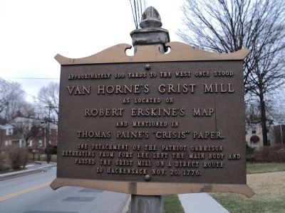
1. Van Horne’s Grist Mill Marker
Van Horne’s Grist Mill
as located on
Robert Erskine’s Map
and mentioned in
Thomas Paine’s “Crisis” paper.
One detachment of the Patriot Garrison retreating from Fort Lee, left the main body and passed the grist mill on a direct route to Hackensack Nov. 20, 1776.
Topics. This historical marker is listed in this topic list: War, US Revolutionary. A significant historical date for this entry is October 20, 1869.
Location. 40° 52.468′ N, 73° 59.111′ W. Marker is in Leonia, New Jersey, in Bergen County. It is at the intersection of Grand Avenue and Lakeview Avenue, on the right when traveling south on Grand Avenue. Touch for map. Marker is in this post office area: Leonia NJ 07605, United States of America. Touch for directions.

Regionally, this marker is in New Jersey’s North Jersey, in Greater Newark, and in the New York City Metropolitan Area. It is also in the American Northeast, in the Mid-Atlantic, and on the Eastern Seaboard. Globally, it is in the North Atlantic Region, North America, the Western Hemisphere, the Western World, and the Anglosphere. Historically,
this page online
Other nearby markers. At least 8 other markers are within walking distance of this marker: English Neighborhood Road (within shouting distance of this marker); Vreeland House (about 300 feet away, measured in a direct line); Slave Burial Ground (approx. 0.3 miles away); Dutch Reformed Church (approx. 0.6 miles away); De Mott – Westervelt House (approx. ¾ mile away); George Washington Memorial Monument (approx. 0.8 miles away); Days Tavern (approx. 0.8 miles away); Continental Army Encampment (approx. 0.9 miles away). Touch for a list and map of all markers in Leonia.
Photographed by Bill Coughlin, March 9, 2011
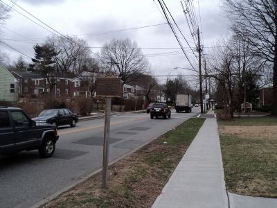
2. Marker in Leonia
This view of the marker looks south on Grand Avenue, in the direction of Fort Lee.
Photographed by Bill Coughlin, March 9, 2011
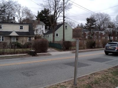
3. Van Horne’s Grist Mill Marker
George Washington and the Continental Army passed this point during their retreat across New Jersey in November of 1776.
Credits. This page was last revised on June 16, 2016. It was originally submitted on March 9, 2011, by Bill Coughlin of Woodland Park, New Jersey. This page has been viewed 1,961 times since then and 57 times this year. Photos: 1, 2, 3. submitted on March 9, 2011, by Bill Coughlin of Woodland Park, New Jersey.
