Montezuma Castle National Monument in Yavapai County, Arizona — The American Mountains (Southwest)
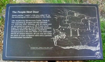
The People Next Door
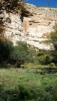
Here’s another “castle” – this one called “A” by the archeologists who excavated it in the 1930s.
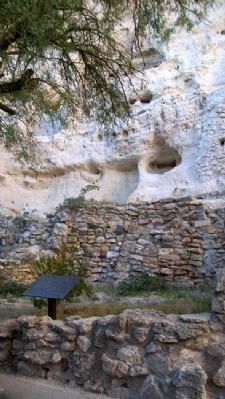
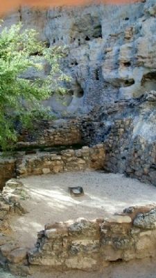
Like neighboring Montezuma Castle, Castle A was occupied by Sinagua farmers between A.D. 1200 and 1450. However, with 45 rooms and an estimated occupancy of 100, it was much larger. It’s not nearly as well preserved, because sometime before the Sinaguas’ mysterious disappearance in the late 1400s a fire destroyed almost all interior features. All you can see today are parts of a few collapsed walls and a partially reconstructed foundation.
Erected by National Park Service, U.S. Department of the Interior.
Topics. This historical marker is listed in these topic lists: Anthropology & Archaeology • Forts and Castles • Settlements & Settlers. A significant historical year for this entry is 1200.
Location. 34° 36.71′ N, 111° 50.558′ W. Marker is in Montezuma Castle National Monument, Arizona, in Yavapai County. Marker is along the walking trail leading from the visitor center. Touch for map. Marker is at or near this postal address: Montezuma Castle Road, Camp Verde AZ 86322, United States of America. Touch for directions.
Other nearby markers. At least 8 other markers are within 3 miles of this marker, measured as the crow flies. Lifeline / Prehistoric Produce (within shouting distance of this marker); The Neighborhood / Mysterious Departures (within shouting distance of this marker); The Way Up / Construction Sequence (within shouting distance of this marker); The Community (about 400 feet away, measured in a direct line); Welcome to The Castle (about 500 feet away); Macaw Pen Stone? (approx. 0.2 miles away); Pecan Lane Rural Historic Landscape (approx. 2.7 miles away); Chaves Historic Trail (approx. 3 miles away). Touch for a list and map of all markers in Montezuma Castle National Monument.
Also see . . . Montezuma Castle National Monument. (Submitted on March 13, 2011, by William Fischer, Jr. of Scranton, Pennsylvania.)
Credits. This page was last revised on August 16, 2020. It was originally submitted on March 13, 2011, by William Fischer, Jr. of Scranton, Pennsylvania. This page has been viewed 903 times since then and 37 times this year. Photos: 1, 2, 3, 4. submitted on March 13, 2011, by William Fischer, Jr. of Scranton, Pennsylvania.


