Christiansburg in Montgomery County, Virginia — The American South (Mid-Atlantic)
Lewis-McHenry Duel
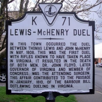
In this town occurred the duel between Thomas Lewis and John McHenry in May, 1808. This was the first duel with rifles known to have taken place in Virginia. It resulted in the death of both men. Dr. John Floyd, later Governor of Virginia and member of Congress, was the attending surgeon. This affair contributed to the passage in January, 1810, of the Barbour Bill outlawing dueling in Virginia.
Erected 1951 by Virginia State Library. (Marker Number K-71.)
Topics and series. This historical marker is listed in this topic list: Government & Politics. In addition, it is included in the Virginia Department of Historic Resources (DHR) series list. A significant historical month for this entry is January 1810.
Location. 37° 7.78′ N, 80° 24.532′ W. Marker is in Christiansburg, Virginia, in Montgomery County. Marker is at the intersection of West Main Street (U.S. 11) and South Franklin Street, on the right when traveling north on West Main Street. Touch for map. Marker is at or near this postal address: 10 West Main Street, Christiansburg VA 24073, United States of America. Touch for directions.
Other nearby markers. At least 8 other markers are within walking distance of this marker. Montgomery County War Memorial (a few steps from this marker); Montgomery County Confederate Monument (within shouting distance of this marker); Confederate Christiansburg (within shouting distance of this marker); Community Life (within shouting distance of this marker); Education (within shouting distance of this marker); Slavery (within shouting distance of this marker); Christiansburg Presbyterian Church (about 700 feet away, measured in a direct line); The Oaks (approx. 0.4 miles away). Touch for a list and map of all markers in Christiansburg.
Also see . . . From the Archives: Lewis-McHenry duel in 1808 said to be cause of anti-duel legislation being passed. Published online by the Salem (VA.) Times-Register, August 15, 2023
The duel in which Thomas Lewis, grandson of General Andrew Lewis, was killed in 1808, was one of the reasons that dueling was outlawed in this state soon after that fatal affray. Thomas Lewis was killed near Christiansburg on the first Monday in May of 1808 in a duel with John McHenry, sheriff of Montgomery county.(Submitted on February 28, 2024, by Mark Parker of Hickory, North Carolina.)
Credits. This page was last revised on March 5, 2024. It was originally submitted on April 4, 2011, by Bernard Fisher of Richmond, Virginia. This page has been viewed 1,560 times since then and 147 times this year. Photos: 1, 2, 3, 4. submitted on April 4, 2011, by Bernard Fisher of Richmond, Virginia.


