Blacksburg in Montgomery County, Virginia — The American South (Mid-Atlantic)
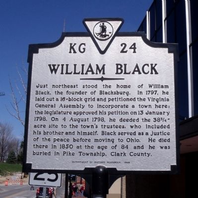
William Black
Erected 1998 by Department of Historic Resources. (Marker Number KG-24.)
Topics and series. This historical marker is listed in this topic list: Settlements & Settlers. In addition, it is included in the Virginia Department of Historic Resources (DHR) series list. A significant historical date for this entry is January 13, 1798.
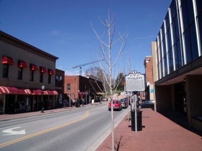
Location. 37° 13.807′ N, 80° 24.883′ W. Marker is in Blacksburg, Virginia, in Montgomery County. Marker is at the intersection of North Main Street (Business U.S. 460) and Jackson Street NE (Virginia Route 785), on the right when traveling north on North Main Street. Touch for map. Marker is at or near this postal address: 200 North Main Street, Blacksburg VA 24060, United States of America. Touch for directions.
Other nearby markers. At least 8 other markers are within walking distance of this marker. The Cellar Building (about 300 feet away, measured in a direct line); The Armory (about 400 feet away); The Early Years / Campus Over Time (about 600 feet away); William Frank Henderson (about 700 feet away); Virginia Polytechnic Institute and State University (about 700 feet away); People and Place / Land Grant College (about 700 feet away); John Houston Squires (approx. 0.2 miles away); Five Chimneys (approx. ¼ mile away). Touch for a list and map of all markers in Blacksburg.
Also see . . . History of Blacksburg. Town of Blacksburg, Virginia. (Submitted on April 4, 2011.)
Credits. This page was last revised on November 10, 2021. It was originally submitted on April 4, 2011, by Bernard Fisher of Richmond, Virginia. This page has been viewed 1,703 times since then and 95 times this year. Photos: 1, 2. submitted on April 4, 2011, by Bernard Fisher of Richmond, Virginia.

