Near Staffordsville in Giles County, Virginia — The American South (Mid-Atlantic)
Giles County
⎯⎯⎯
Pulaski County
Photographed by Bernard Fisher, April 2, 2011
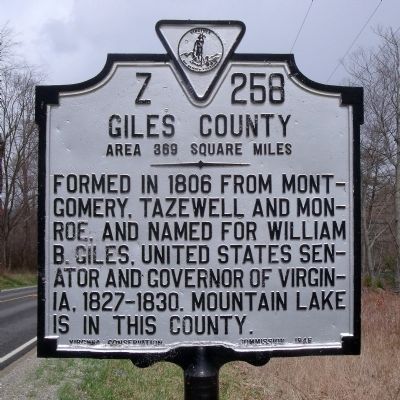
1. Giles County Marker (obverse)
Giles County. Area 369 square miles. Formed in 1806 from Montgomery, Tazewell, and Monroe, and named for William B. Giles, United States Senator and Governor of Virginia, 1827-1830. Mountain Lake is in this county.
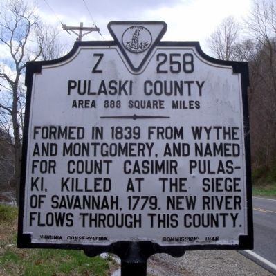
Pulaski County. Area 333 square miles. Formed in 1839 from Wythe and Montgomery, and named for Count Casimir Pulaski, killed at the siege of Savannah, 1779. New River flows through this county.
Erected 1946 by Virginia Conservation Commission. (Marker Number Z-258.)
Topics and series. This historical marker is listed in this topic list: Political Subdivisions. In addition, it is included in the Virginia Department of Historic Resources (DHR) series list. A significant historical year for this entry is 1806.
Location. 37° 12.081′ N, 80° 44.185′ W. Marker is near Staffordsville, Virginia, in Giles County. It is on Pulaski Giles Turnpike (Virginia Route 100) 0.3 miles north of Little Creek Road ( Route 601), on the right when traveling north. Touch for map. Marker is in this post office area: Pearisburg VA 24134, United States of America. Touch for directions.

Regionally, this marker is in Southwest Virginia,
this page online
Other nearby markers. At least 8 other markers are within 6 miles of this marker, measured as the crow flies: Old-Fashioned Camp Meeting (approx. 2.3 miles away); Battle of Cloyd’s Mountain (approx. 2.4 miles away); Mountain Evangelist (approx. 3.2 miles away); Est. 1767 (approx. 4.6 miles away); Thomas Farley, Sr. (approx. 4.7 miles away); Rearguard Action (approx. 5½ miles away); Battle of Cloyd's Farm (approx. 5½ miles away); a different marker also named Battle of Cloyd's Mountain (approx. 5½ miles away). Touch for a list and map of all markers in Staffordsville.
Also see . . .
1. Giles County, Virginia. (Submitted on April 4, 2011, by Bernard Fisher of Richmond, Virginia.)
2. Pulaski County, Virginia.
Photographed by Bernard Fisher, April 2, 2011
2. Pulaski County Marker (reverse)
Photographed by Bernard Fisher, April 2, 2011
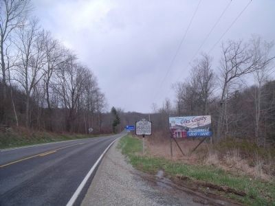
3. Pulaski Giles Tpke (facing north)
Photographed by Bernard Fisher, April 2, 2011
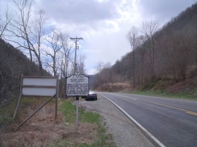
4. Pulaski Giles Tpke (facing south)
Credits. This page was last revised on July 7, 2021. It was originally submitted on April 4, 2011, by Bernard Fisher of Richmond, Virginia. This page has been viewed 747 times since then and 28 times this year. Photos: 1, 2, 3, 4. submitted on April 4, 2011, by Bernard Fisher of Richmond, Virginia.
