Central Vancouver in Greater Vancouver, British Columbia — Canada’s West Coast (North America)
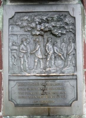
The Old Maple
tree under whose branches
the pioneers met in 1885 and
chose the name "Vancouver"
for this city.
Topics. This historical marker is listed in this topic list: Settlements & Settlers. A significant historical year for this entry is 1885.
Location. 49° 17′ N, 123° 6.259′ W. Marker is in Vancouver, British Columbia, in Greater Vancouver. It is in Central Vancouver. Marker is at the intersection of Powell Street and Carrall Street on Powell Street. Touch for map. Marker is in this post office area: Vancouver BC V6B 1B2, Canada. Touch for directions.
Other nearby markers. At least 8 other markers are within walking distance of this marker. "Gassy Jack" (here, next to this marker); Byrnes Block (a few steps from this marker); Nagle Bros. Garage (within shouting distance of this marker); The Packing House (within shouting distance of this marker); Abrams Block (within shouting distance of this marker); Cordage Building (within shouting distance of this marker); The Grand Hotel / The Terminus Hotel (within shouting distance of this marker); Robinson Block / Rene Building (about 90 meters away, measured in a direct line). Touch for a list and map of all markers in Vancouver.
Also see . . . Vancouver. GeoBC provides a short history of Vancouver and its name: "Named in 1886 at the suggestion of Sir W.C. VanHorne, then-CEO of the CPR, after Captain George Vancouver, RN, (1757-1798), famous explorer of the Pacific Coast of Northwest America, who had visited these waters 1790 - 1792...." (Submitted on April 9, 2011.)
Photographed By Andrew Ruppenstein, June 10, 2010
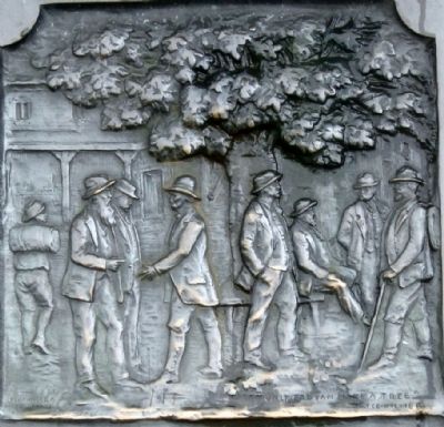
2. The Old Maple Marker- closeup of artwork on marker
In the lower left of the image is what appears to be the artist's name, although illegible. In the lower right there is an oddity of sorts: The last half of the last couplet in Joyce Kilmer's poem Trees, "Only God can make a tree".
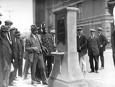
Photographed By Stuart Thompson, June 13, 1925
3. Charles Marega unveils Maple Tree Memorial
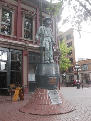
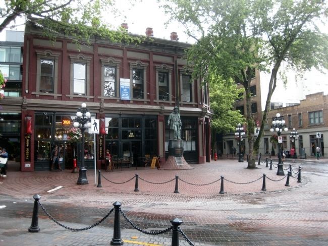
This 1925 image, courtesy of the City of Vancouver Archives, shows the unveiling of the Maple Tree Memorial - a fountain with this marker, at the intersection of Water and Carrall Streets (the location of Maple Tree Square). The marker is now mounted, however, on the statue of John "Gassy Jack" Deighton in Maple Tree Square.
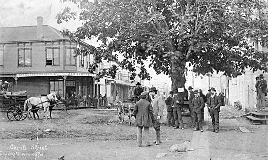
Photographed By H.T. Devine, June 7, 1886
4. View looking south up Carrall Street, with the Old Maple Tree
This 1886 photo of the Maple Tree, courtesy of the City of Vancouver Archives, would seem to bear more than a passing resemblance to the image on the marker. Taken in June 1886, shortly after Vancouver was incorporated. Prior to incorporation, the area had formally been known as Granville, and also informally as "Gastown" (after the founder of the settlement, John "Gassy Jack" Deighton).
Credits. This page was last revised on February 16, 2023. It was originally submitted on April 9, 2011, by Andrew Ruppenstein of Lamorinda, California. This page has been viewed 866 times since then and 38 times this year. Photos: 1, 2, 3, 4, 5, 6. submitted on April 9, 2011, by Andrew Ruppenstein of Lamorinda, California. • Syd Whittle was the editor who published this page.
