Inwood in Manhattan in New York County, New York — The American Northeast (Mid-Atlantic)
The Hessian Military Hut
Revolutionary War Heritage Trail
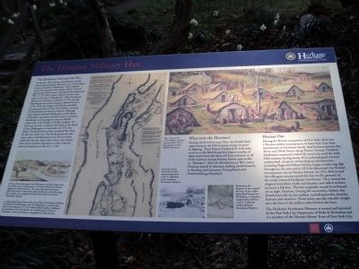
The Dyckman Farm and the War
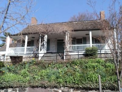
By the late 18th century, the Dyckman family owned approximately 250 acres, one of the largest farms in northern Manhattan. Their original home was located at the Harlem River, north of present day 207th Street. During the Revolutionary War (1775-1783), major military activity took place in the area of Manhattan. After forcing the British out of Boston in March of 1776, George Washington moved his troops to defend the port of New York. By August, the British assembled an enormous fleet in New York Harbor, carrying 45,000 British and Hessian soldiers. Although these soldiers defeated Washington at the Battle of Brooklyn, he maneuvered his army to northern Manhattan and managed to stop the British temporarily at the Battle of Harlem Heights. He tried one last time to defend New York at the Battle of Fort Washington in November of 1776, but failed. The British forces then occupied New York for the rest of the war. The Dyckman family, like many others, fled Manhattan and did not return until after the war. Upon their return, they found their home had been destroyed, so they built the present farmhouse on this site c. 1784.
Who were the Hessians?
During the Revolutionary War, the British hired approximately 30,000 German troops to assist in fighting. Their Prince, Frederick II, sold their service to the British and the largest number of them came from the State of Hessen-Kassel, so all of the German troops became known generically as “Hessians.” After the Revolutionary War, many Hessians stayed in America, settling predominantly in Reading and Lancaster, Pennsylvania and Fredericksburg, Maryland.
Hessian Hut
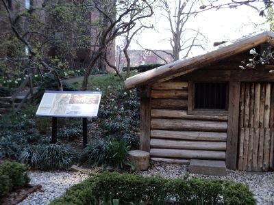
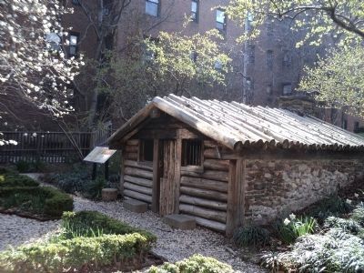
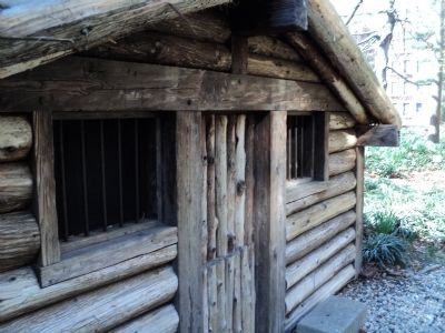
During the British occupation of New York, there was a Hessian soldier encampment of more than sixty huts constructed on Dyckman family land between present-day 201st and 204th Streets along Payson Avenue. Northern Manhattan remained a relatively rural area until the early 20th century, leaving many of its archaeological remains undisturbed. Amateur archaeologists and historians, including Reginald Pelham Bolton, began conducting digs throughout the area and in 1914 he discovered the Hessian encampment site on Payson Avenue. In 1915, Bolton and his colleagues reconstructed this hut on the grounds of the newly restored Dyckman Farmhouse. They moved the original stone floor, walls and fireplace and added timbers to create a full hut. This hut originally would have housed six to eight Hessians. During the excavation, Bolton also found items left by the soldiers, including bottles, buckles, buttons and ceramics. These items provide valuable insight into the lives of the soldiers who lived in the huts.
The Dyckman Farmhouse Museum is owned and operated by the New York City Department of Parks & Recreation and is a member of the Historic Trust of New York City.
Topics. This historical marker is listed in this topic list: War, US Revolutionary. A significant historical month for this entry is March 1776.
Location. 40° 52.062′ N, 73° 55.368′ W. Marker is in Manhattan, New York, in New York County. It is in Inwood. Marker can be reached from the intersection of Broadway (U.S. 9) and 204th Street, on the left when traveling north. Marker is located behind the Dyckman Farmhouse Museum. Touch for map. Marker is at or near this postal address: 4881 Broadway, New York NY 10034, United States of America. Touch for directions.
Other nearby markers. At least 8 other markers are within walking distance of this marker. The Military Hut (a few steps from this marker); Dyckman Farmhouse Museum (within shouting distance of this marker); Shorakkopoch (approx. 0.4 miles away); Fort Tryon (approx. 0.7 miles away); Fort Tryon Park (approx. 0.7 miles away); Margaret Cochran Corbin (approx. 0.8 miles away); Colonel William Baxter (approx. 0.9 miles away); Carolina Baptist Church (approx. 0.9 miles away). Touch for a list and map of all markers in Manhattan.
More about this marker. The top of the marker contains a picture of the Hessian encampment and shows a number of Hessian huts. It has a caption of “Hut Camp of the 17th Regiment of Foot, Inwood Hill, N.Y.C. Rendering by Ward Dunsmore.” Two photographs appear at the bottom of the marker. One depicts workers “Excavating the fireplace at the original hut site. [Pictured are] Left to right: John Ward Dunsmore, RP Bolton, A Hopkins, [and] unidentified children. c. 1915”. The second shows the “Reconstruction of the hut on the museum grounds, c. 1915.” Both photos are from the Collection of the Dyckman Farmhouse Museum.
The left of the marker features a picture showing “A view of the attack against Fort Washington and rebel redoubts near New York on the 16th of November 1776 by British and Hessian brigade by Thomas Davies. The house depicted in the lower right hand corner is that of the Nagle family; just to the left along the coastline is the original Dyckman homestead. Courtesy of Winsterhaur Museum.”
Also on the markers is “A geographical map of the northern part of New York Island, exhibiting the plan of Fort Washington, now Fort Knyphausen, with the rebels line in the south …1777, by Claude Joseph Sauthier. Published by permission of the Rt. Horsbile, the Commissioners of Trade & Plantations, Library of Congress, Geography and Map Division.”
Also see . . .
1. The Battle of Fort Washington, November 16, 1776 at Fort Washington, New York. The American Revolutionary War website. (Submitted on April 10, 2011, by Bill Coughlin of Woodland Park, New Jersey.)
2. The 1783 Dyckman Farmhouse -- Broadway and 204th Street. "Daytonian in Manhattan" entry. (Submitted on April 13, 2020, by Larry Gertner of New York, New York.)
Credits. This page was last revised on December 13, 2023. It was originally submitted on April 10, 2011, by Bill Coughlin of Woodland Park, New Jersey. This page has been viewed 1,759 times since then and 102 times this year. Last updated on November 30, 2023, by Carl Gordon Moore Jr. of North East, Maryland. Photos: 1, 2, 3, 4, 5. submitted on April 10, 2011, by Bill Coughlin of Woodland Park, New Jersey. • Michael Herrick was the editor who published this page.
