
Savage in Scott County, Minnesota — The American Midwest (Upper Plains)
Camp Savage
🇺🇸
Photographed by Keith L, April 30, 2011
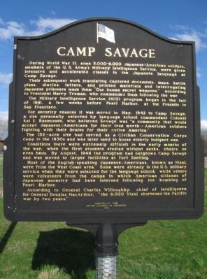
1. Camp Savage Marker
During World War II, some 5,000-6,000 Japanese American soldiers, members of the U.S. Army's Military Intelligence Service, were given intensive and accelerated classes in the Japanese language at Camp Savage.
Their subsequent work translating captured documents, maps, battle plans, diaries, letters, and printed materials and interrogating Japanese prisoners made them "Our human secret weapons," according to President Harry Truman, who commended them following the war.
The Military Intelligence Service (MIS) program began in the fall of 1941, a few weeks before Pearl Harbor, at the Presidio in San Francisco.
For security reasons it was moved in May, 1942 to Camp Savage, a site personally selected by language school commandant Colonel Kai E. Rasmussen, who believed Savage was "a community that would accept Japanese Americans for their true worth – American soldiers fighting with their brains for their native America."
The 132-acre site had served as a Civilian Conservation Corps camp in the 1930s and was later used to house elderly indigent men.
Conditions there were extremely difficult in the early months
this page online
Most of the English-speaking Japanese Americans, known as Nisei, were from the West Coast area. Some were already in the U.S. military service when they were selected for the language school, while others were volunteers from the camps in which American citizens of Japanese ancestry had been interned following the bombing of Pearl Harbor.
According to General Charles Willoughby, chief of intelligence for General Douglas MacArthur, "the 6,000 Nisei shortened the Pacific war by two years."
Erected 1993 by the Savage Chamber of Commerce.
Topics and series. This historical marker is listed in these topic lists: Asian Americans • War, World II. In addition, it is included in the Civilian Conservation Corps (CCC) series list. A significant historical month for this entry is May 1942.
Location. 44° 46.695′ N, 93° 21.117′ W. Marker is in Savage, Minnesota, in Scott County. It is at the intersection of Xenwood Avenue and South Frontage Road, on the
Photographed by Keith L, April 30, 2011
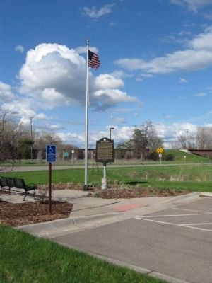
2. Camp Savage Marker

Regionally, this marker is in the Minnesota River Valley and in the Twin Cities Metropolitan Area. It is also in the American Midwest and in the Corn Belt. Globally, it is in North America, the Western Hemisphere, the Western World, and the Anglosphere. Historically, it finds itself in what was once Rupert’s Land, the territory of the Mississippian Culture, and the Louisiana Purchase.
Other nearby markers. At least 8 other markers are within 5 miles of this marker, measured as the crow flies: Bloomington Town Hall (approx. 3½ miles away); Fallen Heroes Memorial (approx. 3.7 miles away); Civil War Monument (approx. 4 miles away); Minnesota River Valley (approx. 4.6 miles away); Dakota Life (approx. 4.6 miles away); Changing Landscapes (approx. 4.6 miles away); Pond Family Heritage Timeline (approx. 4.6 miles away); Missionaries to the Dakota (approx. 4.6 miles away).
Also see . . .
1. Camp Savage. Wikipedia entry. (Submitted on April 13, 2011.)
2. World War II Camp Savage.
Photographed by Keith L, April 30, 2011
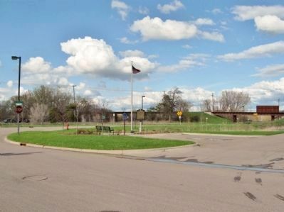
3. Camp Savage Marker
Credits. This page was last revised on February 1, 2026. It was originally submitted on April 13, 2011, by Keith L of Wisconsin Rapids, Wisconsin. This page has been viewed 5,721 times since then and 293 times this year. Photos: 1, 2, 3. submitted on May 5, 2011, by Keith L of Wisconsin Rapids, Wisconsin.
