Green Bay in Prince Edward County, Virginia — The American South (Mid-Atlantic)
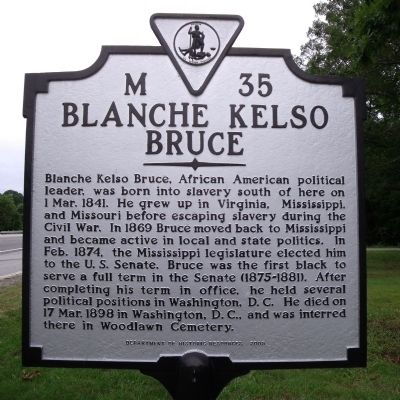
Blanche Kelso Bruce
Photographed by Bernard Fisher, May 18, 2010
1. Blanche Kelso Bruce Marker
Erected 2005 by Department of Historic Resources. (Marker Number M-35.)
Topics and series. This historical marker is listed in these topic lists: African Americans • Government & Politics. In addition, it is included in the Virginia Department of Historic Resources (DHR) series list. A significant historical month for this entry is February 1874.
Location. 37° 8.16′ N, 78° 18.699′ W. Marker is in Green Bay, Virginia, in Prince Edward County. It is at the intersection of Patrick Henry Highway (U.S. 360) and Tower
this page online

Regionally, this marker is in the Piedmont, in Southside Virginia, and specifically in Central Virginia. It is also in the American South and specifically in the Upper South. Globally, it is in North America, the Western Hemisphere, the Western World, and the Anglosphere. Historically, it finds itself in what was once the territory of the Mississippian Culture, one of the original Thirteen Colonies, one of the Confederate States of America, and the Antebellum South.
Other nearby markers. At least 8 other markers are within 5 miles of this marker, measured as the crow flies: CCC Company 1390 (here, next to this marker); a different marker also named St. Matthew's Lutheran Church Christian Day School (approx. 3.1 miles away); Twin Lakes State Park (approx. 3.3 miles away); Pushing the Boundaries (approx. 3.4 miles away); Prince Edward State Park: A Refuge of Freedom (approx. 3.4 miles away); Prince Edward State Park for Negroes
Photographed by Bernard Fisher, May 18, 2010
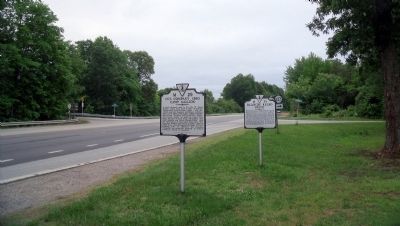
2. Patrick Henry Hwy & Tower Rd (facing west)
Another marker is no longer nearby. St. Matthew's Lutheran Church Christian Day School (was approx. 3.1 miles away but has been replaced with another marker now near it).
Related marker. Click here for another marker that is related to this marker. To better understand the relationship, study each marker in the order shown.
Also see . . .
1. Blanche Kelso Bruce (1841-1898). Biographical Directory of the United States Congress (Submitted on May 23, 2010.)
2. Blanche Kelso Bruce. United States Senate (Submitted on May 23, 2010.)
circa 1880
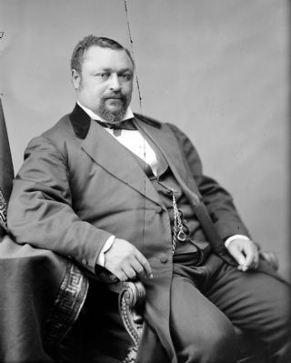
3. Hon. Blanche Kelso Bruce of Mississippi
Library of Congress [LC-BH832- 30088]
Credits. This page was last revised on November 11, 2021. It was originally submitted on May 23, 2010, by Bernard Fisher of Richmond, Virginia. This page has been viewed 1,474 times since then and 72 times this year. Last updated on April 14, 2011, by Richard E. Miller of Oxon Hill, Maryland. Photos: 1, 2, 3. submitted on May 23, 2010, by Bernard Fisher of Richmond, Virginia. • Craig Swain was the editor who published this page.
