Huger in Berkeley County, South Carolina — The American South (South Atlantic)
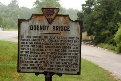
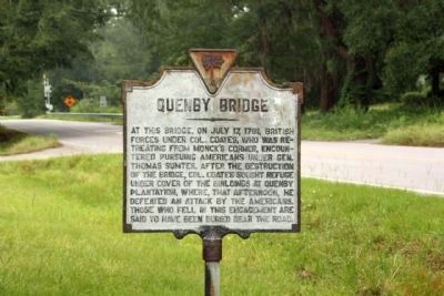
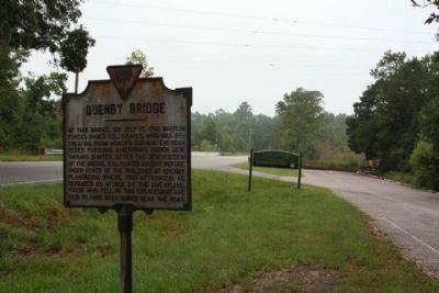
Quenby Bridge
Topics. This historical marker is listed in this topic list: War, US Revolutionary. A significant historical month for this entry is July 1876.
Location. 33° 5.694′ N, 79° 48.398′ W. Marker is in Huger, South Carolina, in Berkeley County. Marker is on Cainhoy Road (State Road 8-98), on the right when traveling south. Marker is located at North side of Cooper River (west branch) at bridge, at the boat ramp parking lot. Touch for map. Marker is in this post office area: Huger SC 29450, United States of America. Touch for directions.
Other nearby markers. At least 8 other markers are within 10 miles of this marker, measured as the crow flies. Quinby Bridge & Shubrick’s Plantation: The Disastrous “Raid of the Dog Days” (within shouting distance of this marker); Silk Hope Plantation (approx. 1.3 miles away); Pompion Hill Chapel (approx. 2 miles away); Brabant Plantation (approx. 5.8 miles away); Strawberry Chapel (approx. 7.3 miles away); Mepkin Plantation (approx. 8.1 miles away); St. Thomas Church (approx. 9.7 miles away); Francis Marion (approx. 10 miles away). Touch for a list and map of all markers in Huger.
More about this marker. Huger is pronounceed "u-gee". It is a French Huguenot family name. Likewise, the family name "Horry" is "orr-ee".
Also see . . . Touring South Carolina's Revolutionary War Sites By Daniel W. Barefoot, page 38. Battle of Quenby Bridge (Submitted on October 16, 2009, by Mike Stroud of Bluffton, South Carolina.)
Credits. This page was last revised on June 16, 2016. It was originally submitted on October 16, 2009, by Mike Stroud of Bluffton, South Carolina. This page has been viewed 2,435 times since then and 168 times this year. Last updated on April 23, 2011, by Cathi Lee of Moncks Corner, South Carolina. Photos: 1, 2, 3. submitted on October 16, 2009, by Mike Stroud of Bluffton, South Carolina.


