Perrysburg in Wood County, Ohio — The American Midwest (Great Lakes)
Fort Meigs / Introduction 1
The War of 1812
Inscription.
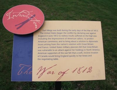
Fort Meigs was built during the early days of the War of 1812. The United States began the conflict by declaring war against England in June 1812 to redress insults suffered on the high seas including the impressment of American sailors; to protect American commerce; and to bring about a solution to diplomatic issues arising from the nation's relation with Great Britain and France. United States military planners felt that Great Britain was vulnerable to an attack against her holdings in North America. American supporters of the war felt that a swift, incisive invasion of Canada would bring England quickly to her knees and the negotiating table.
Topics. This historical marker is listed in these topic lists: Forts and Castles • War of 1812. A significant historical month for this entry is June 1812.
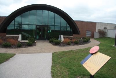
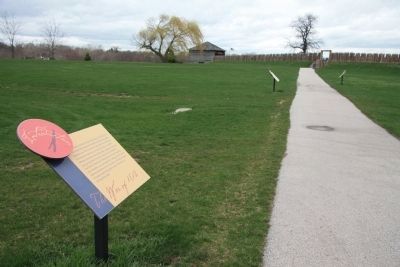
Location. 41° 33.071′ N, 83° 39.184′ W. Marker is in Perrysburg, Ohio, in Wood County. Marker can be reached from West Indiana Avenue (Ohio Route 65) north of Fort Meigs Road, on the right when traveling south. This historical marker is the first in a series of markers that make up a walking tour of Fort Meigs. This particular marker is located just outside of the back doorway of the park's visitor center, along the walkway that leads from the visitor center to the entrance of the reconstructed fort. Touch for map . Marker is in this post office area: Perrysburg OH 43551, United States of America. Touch for directions.
Other nearby markers. At least 8 other markers are within walking distance of this marker. Fort Meigs / Introduction 2 (a few steps from this marker); Fort Meigs / Introduction 3 (a few steps from this marker); Fort Meigs / Introduction 4 (within shouting distance of this marker); Virginia Soldiers Who Died At Fort Meigs Or In Ohio During the War of 1812 (within shouting distance of this marker); 17th Infantry Regiment (about 300 feet away, measured in a direct line); Fort Meigs / Construction (about 300 feet away); In Memory Of Michael Hayes, Timothy Hayes, Thomas Hayes (about 300 feet away); Memorial Garden (about 300 feet away). Touch for a list and map of all markers in Perrysburg.
Credits. This page was last revised on June 16, 2016. It was originally submitted on April 30, 2011, by Dale K. Benington of Toledo, Ohio. This page has been viewed 564 times since then and 8 times this year. Photos: 1, 2, 3. submitted on April 30, 2011, by Dale K. Benington of Toledo, Ohio.


