Leavenworth in Leavenworth County, Kansas — The American Midwest (Upper Plains)
The First Public Park in Kansas
North Esplanade Park and Historic District
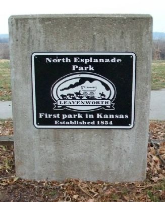
| — | Established 1854 | — |
Photographed by William Fischer, Jr., December 22, 2010
1. The First Public Park in Kansas Marker
Facing Esplanade Street
North Esplanade Historic District
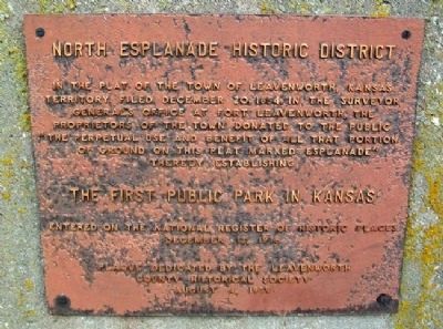
In the plat of the Town of Leavenworth, Kansas Territory, filed December 20, 1854, in the Surveyor General's Office at Fort Leavenworth, the proprietors of the town donated to the public "the perpetual use and benefit of all that portion of ground on this plat marked Esplanade" thereby establishing
The First Public Park in Kansas
Entered on the National Register of Historic Places, December 12, 1976
Plaque dedicated by the Leavenworth County Historical Society, August 4, 1979
Erected 1979 by Leavenworth County Historical Society.
Topics. This historical marker is listed in this topic list: Notable Places. A significant historical date for this entry is December 20, 1884.
Location. 39° 19.338′ N, 94° 54.61′ W. Marker is in Leavenworth, Kansas, in Leavenworth County. It is at the intersection of Esplanade Street and Osage Street, on the right when traveling north on Esplanade Street. Touch for map. Marker is in this post office area: Leavenworth KS 66048, United States of America. Touch for directions.

Regionally, this marker is in Eastern Kansas and specifically in Greater Kansas City. It
this page online
Other nearby markers. At least 8 other markers are within walking distance of this marker: "The Anthonys" (within shouting distance of this marker); Bleeding Kansas (about 400 feet away, measured in a direct line); A Lasting Friendship (about 600 feet away); Lincoln at the Planters (approx. 0.2 miles away); Votes for Women (approx. 0.2 miles away); Planters Hotel (approx. 0.2 miles away); The Great Railroad Era (approx. ¼ mile away); Law Offices of Sherman, Ewing, and McCook (approx. ¼ mile away). Touch for a list and map of all markers in Leavenworth.
Also see . . .
1. North Esplanade Historic District National Register Nomination. (Submitted on May 1, 2011, by William Fischer, Jr. of Reynoldsburg, Ohio.)
2. Leavenworth KS Historic Walking Tour. (Submitted on May 1, 2011, by William Fischer, Jr. of Reynoldsburg, Ohio.)
3. Leavenworth County Historical Society.
Photographed by William Fischer, Jr., December 22, 2010
2. The First Public Park in Kansas Marker
East side
Photographed by William Fischer, Jr., December 22, 2010
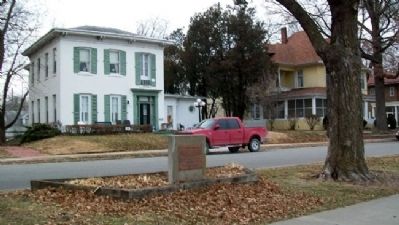
3. The First Public Park in Kansas Marker
Looking west across Esplanade Street from park
Photographed by William Fischer, Jr., December 22, 2010
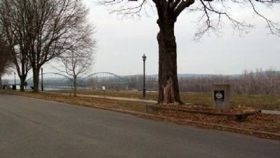
4. The First Public Park in Kansas Marker
Looking NE, with the Missouri River bridge in background.
Photographed by William Fischer, Jr., December 22, 2010
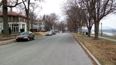
5. View North Along Esplanade Street
Park on right
Photographed by William Fischer, Jr., December 22, 2010
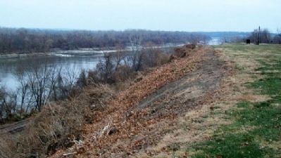
6. View South Along Missouri River
From Esplanade Park
Credits. This page was last revised on June 16, 2016. It was originally submitted on May 1, 2011, by William Fischer, Jr. of Reynoldsburg, Ohio. This page has been viewed 723 times since then and 38 times this year. Photos: 1, 2, 3. submitted on May 1, 2011, by William Fischer, Jr. of Reynoldsburg, Ohio. 4. submitted on May 2, 2011, by William Fischer, Jr. of Reynoldsburg, Ohio. 5, 6. submitted on May 1, 2011, by William Fischer, Jr. of Reynoldsburg, Ohio.
