Locust Grove in Orange County, Virginia — The American South (Mid-Atlantic)
The Mine Run Campaign
Meade vs. Lee
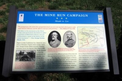
“The delay in the movements of the Third Corps, and, particularly the failure to affect a junction at Robertson’s Tavern, was one of the primary causes of the failure of the recent movement.” — Gen. George Gordon Meade, USA
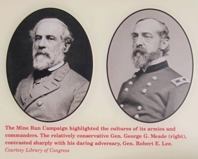
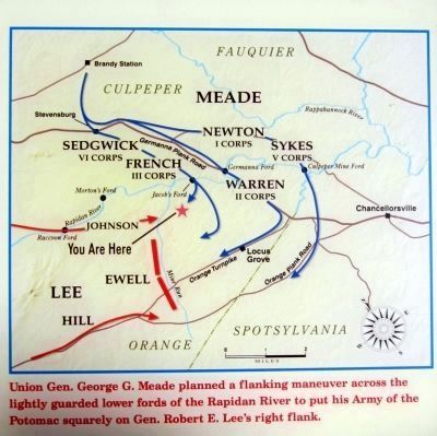
Eager to strike Confederate Gen. Robert E. Lee’s Army of Northern Virginia before winter, Union Gen. George Gordon Meade planned a flanking movement across the Rapidan River late in 1863. Meade intended to force the Southerners to abandon their strong defensive position along the upper Rapidan. Success depended on the timely movement of the different portions of his army and their juncture at Locust Grove, south of the river.
The Mine Run Campaign began on November 26, 1863. Rain, bad roads, and an inadequate knowledge of the terrain hindered Meade’s movements. After long delays and before the Union forces could assemble at Locust Grove, elements of the Union and Confederate armies clashed here at Payne’s Farm on November 27. By the next day, Confederate forces had established a seemingly impregnable line of defenses behind Mine Run, a tributary of the Rapidan. Meade ordered his army back across the Rapidan River and into winter camp. After more than 1,900 combined casualties, both armies returned to the positions they occupied before the Mine Run Campaign.
Erected 2011 by The Civil War Trust and Virginia Civil War Trails.
Topics and series. This historical marker is listed in this topic list: War, US Civil. In addition, it is included in the Virginia Civil War Trails series list. A significant historical month for this entry is November 1862.
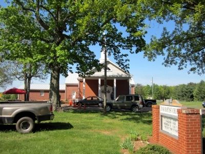
Location. 38° 19.937′ N, 77° 49.712′ W. Marker is in Locust Grove, Virginia, in Orange County. Marker is at the intersection of Zoar Road (Virginia Route 611) and Zoar School Road, on the left when traveling north on Zoar Road. Touch for map. Marker is at or near this postal address: 31334 Zoar Road, Locust Grove VA 22508, United States of America. Touch for directions.
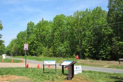
Other nearby markers. At least 8 other markers are within walking distance of this marker. A different marker also named The Mine Run Campaign (here, next to this marker); The Battle of Payne’s Farm (a few steps from this marker); a different marker also named The Battle of Payne’s Farm (approx. 0.2 miles away); a different marker also named The Battle of Payne’s Farm (approx. ¼ mile away); a different marker also named The Battle of Payne’s Farm (approx. ¼ mile away); a different marker also named The Battle of Payne’s Farm
(approx. 0.3 miles away); a different marker also named The Battle of Payne’s Farm (approx. 0.3 miles away); a different marker also named The Battle of Payne’s Farm (approx. 0.3 miles away). Touch for a list and map of all markers in Locust Grove.
Also see . . .
1. Mine Run (Payne's Farm). American Battlefield Trust (Submitted on November 11, 2021.)
2. The Mine Run Campaign by James K. Bryant II. Essential Civil War Curriculum, Virginia Center for Civil War Studies at Virginia Tech (Submitted on November 11, 2021.)
1864
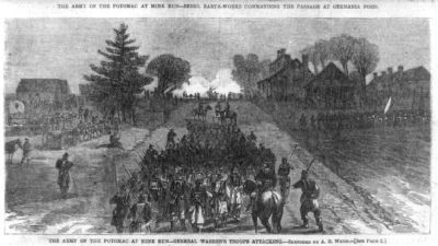
4. The Army of the Potomac at Mine Run
General Warren's troops attacking [Robertson's Tavern, an old Virginia hostelry]. Wood engraving after sketch by A.R. Waud. Harper's Weekly, v. 8, (1864 January 2), p. 12. Library of Congress [LC-USZ62-88336]
The site of Robinson’s Tavern (called Robertson’s Tavern by the soldiers) at Locust Grove is approximately two miles south of Payne’s Farm. The tavern building itself still stands but was moved some 250 yards north on Zoar Road (present-day State Route 611).
The site of Robinson’s Tavern (called Robertson’s Tavern by the soldiers) at Locust Grove is approximately two miles south of Payne’s Farm. The tavern building itself still stands but was moved some 250 yards north on Zoar Road (present-day State Route 611).

Photographed By Bernard Fisher, April 29, 2011
8. Civil War Trust
Saving America’s Hallowed Ground
Saving America’s Hallowed Ground
The Civil War Trust is America’s largest nonprofit organization devoted to saving our nation’s endangered Civil War battlefields. During more than twenty years crusading for preservation, The Trust has rescued from sprawl and development more than 30,000 acres of hallowed ground in twenty states.
Sadly, only one in five Civil War battlefields, so vital to our national heritage, is protected. Nearly thirty acres of contested ground are lost every day. If not for the concerted efforts of the Civil War Trust and its partners, the very land you stand on might be a strip mall, a housing development, or a highway interchange. Already, more than 20 percent of Civil War battlefields have been lost forever. Without well-funded, deliberate, and urgent action, future generations will be denied even more of these places where history happened and heroes walked.
Join the fight to save America’s remaining hallowed ground. Tb learn more about the Civil War Trust and how you can help protect battlefields just like this one, visit us on-line at www.civilwar.org or call toll free at (888) 606-1400.
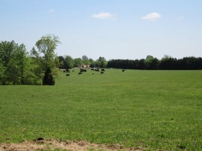
[caption] The Civil War Trust and its partners were able to preserve the beautiful land here at Payne’s Farm forever. - Photo courtesy Garry Adleman
This historic property is preserved thanks in part to a Land and Water Conservation Fund grant administered by the Department of the Interior, National Park Service, American Battlefield Protection Program. Any opinions, findings, and conclusions expressed in this material are those of the author(s) and do not necessarily reflect the views of the Department of the Interior.
Credits. This page was last revised on February 23, 2022. It was originally submitted on May 1, 2011, by Bernard Fisher of Richmond, Virginia. This page has been viewed 1,606 times since then and 73 times this year. Photos: 1, 2, 3, 4, 5, 6. submitted on May 1, 2011, by Bernard Fisher of Richmond, Virginia. 7, 8. submitted on May 2, 2011, by Bernard Fisher of Richmond, Virginia.
