Knights Ferry in Stanislaus County, California — The American West (Pacific Coastal)
Knight's Ferry
1849 - 1930
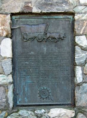
Knight's Ferry was founded by Captain William Knight, a member of Fremont's expedition of 1844. This town was a center of great mining activity and was a distributing point for the mother lode country.
In 1854 the first sawmill and flour mill for this territory was erected by Locke and Dent.
General U.S. Grant visited his brother-in-law George Dent, in 1854.
Knight's Ferry was the county seat of Stanislaus County from 1862 until 1872.
Erected 1930 by Daughters of the American Revolution, Hugh Moss Chapter.
Topics and series. This historical marker is listed in this topic list: Settlements & Settlers. In addition, it is included in the Daughters of the American Revolution, and the Former U.S. Presidents: #18 Ulysses S. Grant series lists. A significant historical year for this entry is 1844.
Location. 37° 49.136′ N, 120° 40.324′ W. Marker is in Knights Ferry, California, in Stanislaus County. Marker is at the intersection of Sonora Road and Dent Street, on the left when traveling west on Sonora Road. Touch for map. Marker is at or near this postal address: 17601 Sonora Road, Oakdale CA 95361, United States of America. Touch for directions.
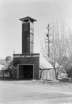
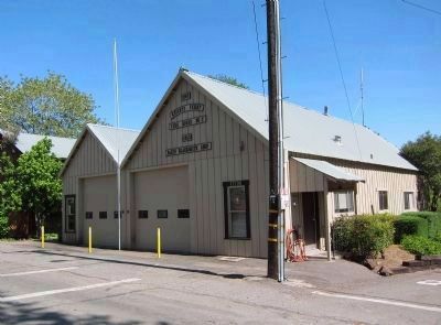
Other nearby markers. At least 8 other markers are within walking distance of this marker. Knights Ferry Hook & Ladder (within shouting distance of this marker); Miller's Saloon (within shouting distance of this marker); Knights Ferry No. 2 (about 300 feet away, measured in a direct line); Knights Ferry - The Store (about 300 feet away); Power Generation (approx. 0.4 miles away); Tulloch’s Mill (approx. 0.4 miles away); Mill House (approx. 0.4 miles away); Knights Ferry Covered Bridge (approx. 0.4 miles away). Touch for a list and map of all markers in Knights Ferry.
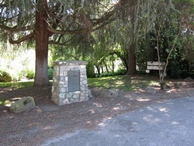
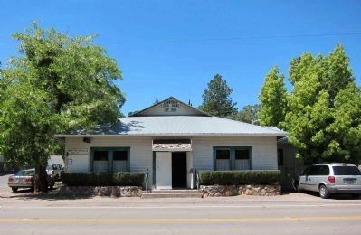
More about this marker. The marker is mounted on a low stone monument in the Knights Ferry Community Club Park, just across the street from the Community Club.
Also see . . . Knight's Ferry. California Gold Country website entry:
Includes links to additional pages for individual historic building's in Knight's Ferry. (Submitted on May 11, 2011.)
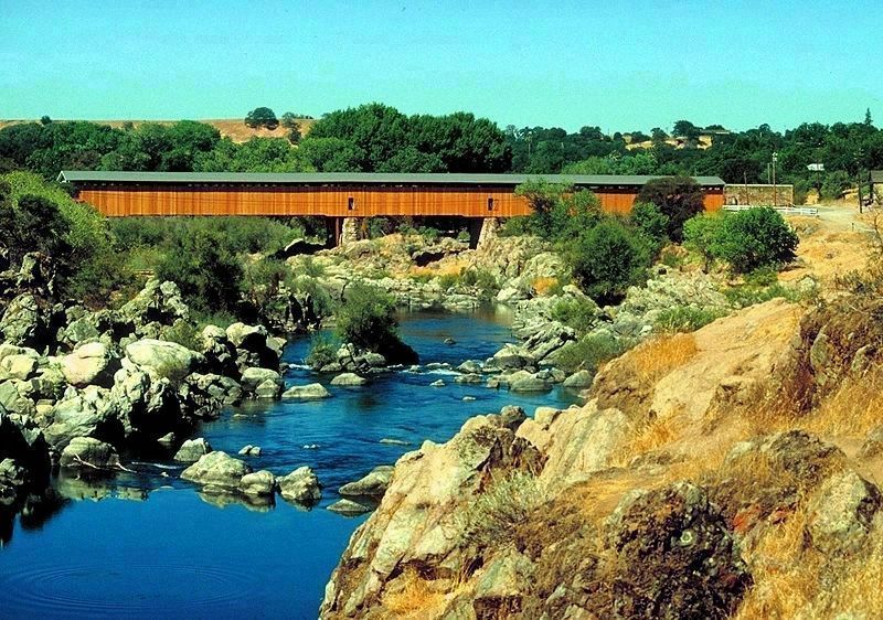
via Snowy Range Reflections, unknown
4. The Knight's Ferry Covered Bridge
Covered Bridges of the Sierra Nevada Region:
Snowy Range Reflections website entry on the history of Knight's Ferry and its covered bridge.
Click for more information.
Snowy Range Reflections website entry on the history of Knight's Ferry and its covered bridge.
Click for more information.
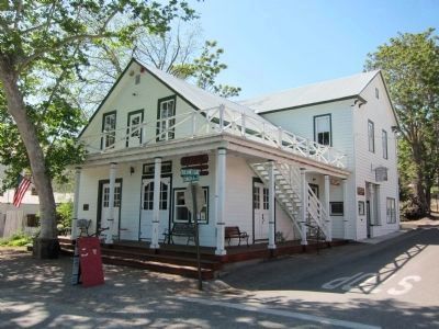
Photographed By Andrew Ruppenstein, April 30, 2011
9. Miller's Hall (17631 Sonora Road)
Constructed around 1864, Miller's Hall has served as a saloon, a pool hall, dance hall, card room, bordello, and private residence. Nowadays Miller's Hall houses the town museum, post office, a read-and-return library, a boutique, the Knight's Ferry Community Services District Office, and an ice cream parlor.
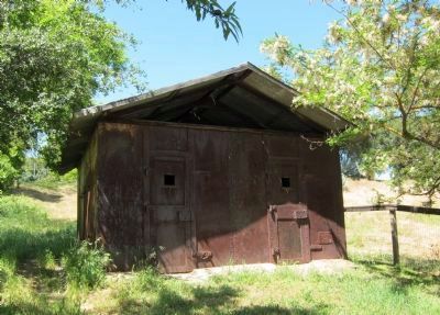
Photographed By Andrew Ruppenstein, April 30, 2011
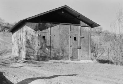
14. Knights Ferry Jail
One source has this building as being a powder house in Oakdale, before being moved to Knights Ferry. The Historic American Building Survey merely notes the structure as 19th Century, without attribution. Yet on the structure itself, barely visible is the lower righthand corner is a small sign saying "Knight's Ferry Jail 1912". Regardless of the jail's construction date, it undoubtedly would have been an extremely uncomfortable place to be stuck in during the hot summer days.
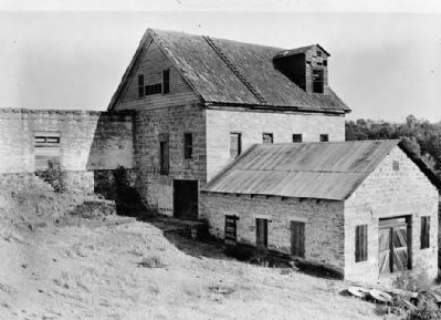
Photographed By Robert W. Kerrigan, circa October 1936
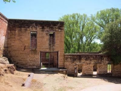
15. Tulloch's Mill - view from northwest
A grist mill stood here as early as the 1850's. A replacement was erected in its place after the flood of 1862, and sometime before 1900 the mill was converted to a hydroelectic plant, which supplied electricity to the area into the late 1920's. (Image courtesy of the Historic American Buildings Survey.)
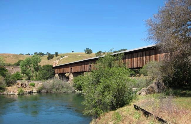
Photographed By Andrew Ruppenstein, April 30, 2011
17. Knight's Ferry Covered Bridge, spanning the Stanislaus River
The Knight's Ferry Bridge was built in 1863-64 to replace an 1857 uncovered wooden truss that was destroyed in a flood. This was an important crossing on the heavily traveled Stockton-Sonora Road during the California Gold Rush. The Knight's Ferry Bridge is the longest covered bridge west of the Mississippi River. - Historic American Buildings Survey statement of significance
Credits. This page was last revised on June 15, 2021. It was originally submitted on May 6, 2011, by Andrew Ruppenstein of Lamorinda, California. This page has been viewed 1,414 times since then and 54 times this year. Photos: 1, 2. submitted on May 6, 2011, by Andrew Ruppenstein of Lamorinda, California. 3. submitted on May 7, 2011, by Andrew Ruppenstein of Lamorinda, California. 4. submitted on June 15, 2021, by Larry Gertner of New York, New York. 5. submitted on May 6, 2011, by Andrew Ruppenstein of Lamorinda, California. 6, 7, 8, 9, 10, 11. submitted on May 7, 2011, by Andrew Ruppenstein of Lamorinda, California. 12. submitted on May 10, 2011, by Andrew Ruppenstein of Lamorinda, California. 13, 14. submitted on May 7, 2011, by Andrew Ruppenstein of Lamorinda, California. 15. submitted on May 10, 2011, by Andrew Ruppenstein of Lamorinda, California. 16. submitted on May 9, 2011, by Andrew Ruppenstein of Lamorinda, California. 17. submitted on May 7, 2011, by Andrew Ruppenstein of Lamorinda, California. • Syd Whittle was the editor who published this page.
