McLean in Fairfax County, Virginia — The American South (Mid-Atlantic)
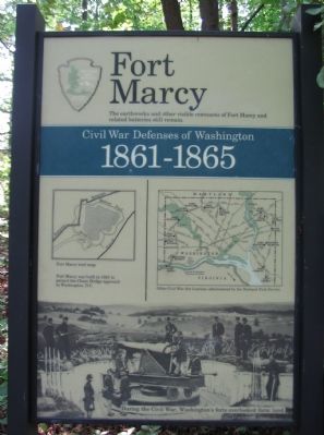
Fort Marcy
Civil War Defenses of Washington
1861-1865
The earthworks and other visible remnants of Fort Marcy and related batteries still remain.
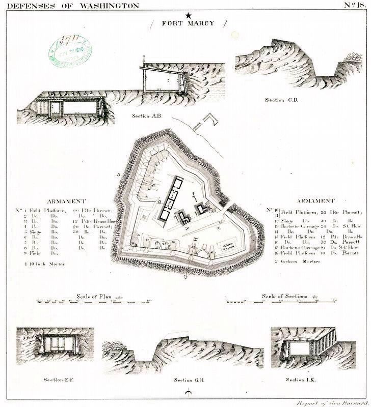
Fort Marcy was built in 1862 to protect the Chain Bridge approach to Washington, D.C.
Erected by National Park Service.
Topics and series. This historical marker is listed in these topic lists: Forts and Castles • War, US Civil. In addition, it is included in the Defenses of Washington series list. A significant historical year for this entry is 1862.
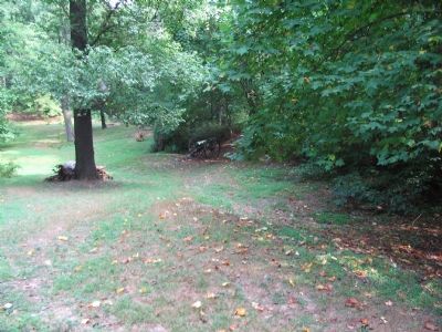
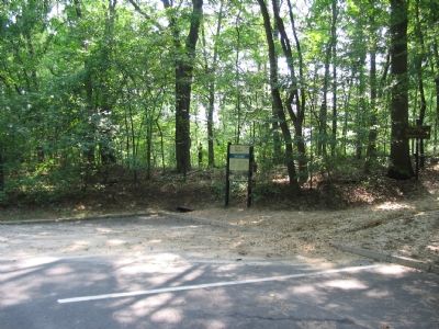
Location. 38° 56.05′ N, 77° 7.533′ W. Marker is in McLean, Virginia, in Fairfax County. Marker can be reached from George Washington Parkway, on the right when traveling west. Located inside the Fort Marcy Park, at the start of the trail leading from the parking area to the fort. The park is best reached from west bound George Washington Parkway, with no exits from the east bound lanes. Touch for map. Marker is in this post office area: Mc Lean VA 22101, United States of America. Touch for directions.
Other nearby markers. At least 8 other markers are within walking distance of this marker. Fort Marcy, Virginia (a few steps from this marker); Auxiliary Battery (within shouting distance of this marker); Inlet Locks (approx. 0.4 miles away in Maryland); Pimmit Run and Chain Bridge (approx. half a mile away); The Mouth of Pimmit Run (approx. half a mile away); Chain Bridge (approx. 0.6 miles away); Original Federal Boundary Stone, District of Columbia, Northwest 4 (approx. 0.6 miles away in Maryland); Clay and Randolph Duel (approx. 0.6 miles away). Touch for a list and map of all markers in McLean.
More about this marker. The marker displays a Fort Marcy trail map on the left. On the right is a map showing "Other Civil War fort locations administered by the National Park Service." The lower portion of the marker is a photograph from the war of a cannon mounted at one of Washington, DC's forts, "During the Civil War, Washington's forts overlooked farm land." The photograph is of a 100-pdr Parrott Rifled Cannon in place at the nearby Fort Totten during the war.
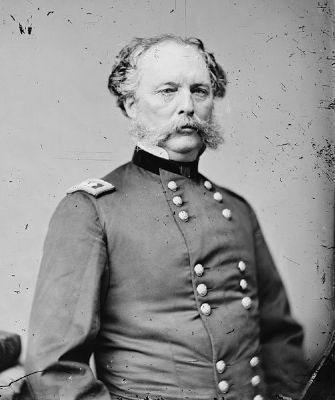
Also see . . . Randolph B. Marcy, U.S. Army. ... Marcy’s 1859 book, The Prairie Traveler: A Handbook for Overland Expeditions, with Maps, Illustrations, and Itineraries of the Principal Routes between the Mississippi and the Pacific, written at the direction of the Department of State and published by the U.S. government,
has been called one of the most important works in making possible the great Western overland migration of the United States in the last half of the 19th century. (Submitted on May 8, 2011, by Richard E. Miller of Oxon Hill, Maryland.)
Additional commentary.
1. Fort Marcy Particulars
From "Mr. Lincoln's Forts: A Guide to the Civil War Defenses of Washington," by Benjamin Franklin Cooling III and Walton H. Owen II:
the fort was originally named for Major General W. F. "Baldy" Smith when built (not to be confused with the nearby Fort C.F. Smith), when built in September 1861. The fort was renamed in honor of Brigadier General Randolph Barns Marcy, father-in-law and Chief of Staff to General McClellan at the time.
The fort had a perimeter of 338 yards and a total of 18 guns. A tally of those guns included three 24-pdr guns, two 12-pdr howitzers, six 30-pdr Parrott rifled guns, three 20-pdr Parrott rifled guns, three 10-pdr Parrott rifled guns, one 10-inch mortar, and two 24-pdr Coehorn mortars.
Units stationed at Fort Marcy included 4th New York Heavy Artillery, 76th and 152nd New York Infantry, 130th and 141st Pennsylvania Infantry, and 3rd Pennsylvania Heavy Artillery.
— Submitted October 18, 2007, by Craig Swain of Leesburg, Virginia.
Additional keywords. Randolph Barnes Marcy
Credits. This page was last revised on March 13, 2024. It was originally submitted on October 18, 2007, by Craig Swain of Leesburg, Virginia. This page has been viewed 2,609 times since then and 45 times this year. Last updated on May 8, 2011, by Richard E. Miller of Oxon Hill, Maryland. Photos: 1, 2, 3. submitted on October 18, 2007, by Craig Swain of Leesburg, Virginia. 4. submitted on May 8, 2011, by Richard E. Miller of Oxon Hill, Maryland. 5. submitted on March 13, 2024, by Allen C. Browne of Silver Spring, Maryland.
