Near McFarlan in Anson County, North Carolina — The American South (South Atlantic)
North Carolina
⎯⎯⎯
South Carolina
Photographed by Paul Crumlish, May 6, 2011
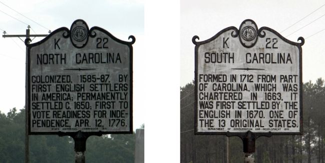
1. North Carolina / South Carolina Marker
North Carolina. Colonized, 1585-87, by first English settlers in America; permanently settled c. 1650; first to vote readiness for independence, Apr. 12, 1776
South Carolina. Formed in 1712 from part of Carolina, which was chartered in 1663, it was first settled by the English in 1670. One of the 13 original states.
Erected 1941 by State Historical Commission. (Marker Number K-22.)
Topics and series. This historical marker is listed in this topic list: Political Subdivisions. In addition, it is included in the North Carolina Division of Archives and History series list. A significant historical date for this entry is April 12, 1825.
Location. 34° 48.473′ N, 79° 58.148′ W. Marker is near McFarlan, North Carolina, in Anson County. It is on U.S. 52 0.2 miles south of Old Sneedsboro Road (North Carolina Highway 1829), on the right when traveling south. Touch for map. Marker is in this post office area: Mc Farlan NC 28102, United States of America. Touch for directions.

Regionally, this marker is in North Carolina’s Piedmont. It is also in the American South and specifically in the Upper South. Globally, it is in North
this page online
Other nearby markers. At least 8 other markers are within 9 miles of this marker, measured as the crow flies: John J. McRae (approx. 3.2 miles away); Sherman's March (approx. 4½ miles away); a different marker also named North Carolina / South Carolina (approx. 4½ miles away); Pegues Place / Revolutionary Cartel (approx. 4.6 miles away in South Carolina); a different marker also named Sherman's March (approx. 7.4 miles away); Chesterfield Post Office (approx. 8.3 miles away in South Carolina); John Craig House (approx. 8.3 miles away in South Carolina); Chesterfield Courthouse (approx. 8.3 miles away in South Carolina).
Another marker is no longer nearby. Sneedsborough (was approx. 3.2 miles away but has been confirmed missing).
Photographed by Paul Crumlish, May 6, 2011
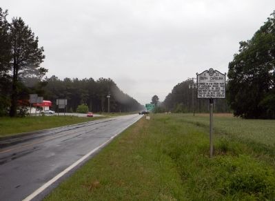
2. Wide view of the North Carolina / South Carolina Marker
Looking south into South Carolina, with the state line marker visible in the background.
Credits. This page was last revised on June 22, 2021. It was originally submitted on May 10, 2011, by PaulwC3 of Northern, Virginia. This page has been viewed 1,094 times since then and 42 times this year. Photos: 1, 2. submitted on May 10, 2011, by PaulwC3 of Northern, Virginia.
