
Wadesboro in Anson County, North Carolina — The American South (South Atlantic)
Boggan-Hammond House
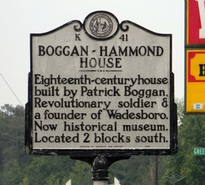
Photographed by Paul Crumlish, May 6, 2011
1. Boggan-Hammond House Marker
Erected 1968 by North Carolina Division of Archives and History. (Marker Number K-41.)
Topics and series. This historical marker is listed in this topic list: Notable Buildings. In addition, it is included in the North Carolina Division of Archives and History series list.
Location. 34° 58.08′ N, 80° 4.477′ W. Marker is in Wadesboro, North Carolina, in Anson County. It is at the intersection of East Caswell Street (U.S. 74) and Greenwood Lane, on the right when traveling east on East Caswell Street. Touch for map. Marker is at or near this postal address: 212 North Washington Street, Wadesboro NC 28170, United States of America. Touch for directions.

Regionally, this marker is in North Carolina’s Piedmont. It is also in the American South and specifically in the Upper South. Globally, it is in North America, the Western Hemisphere, the Western World, and the Anglosphere. Historically, it finds itself in
this page online
Other nearby markers. At least 8 other markers are within 2 miles of this marker, measured as the crow flies: The Women of the Confederacy (about 700 feet away, measured in a direct line); Capt. Patrick Boggan (about 800 feet away); 1900 Total Solar Eclipse (approx. 0.2 miles away); Anson County Memorial Fountain (approx. 0.2 miles away); Blind Boy Fuller (approx. 0.2 miles away); Thomas Samuel Ashe (approx. 0.6 miles away); Anson County Training School (approx. 0.8 miles away); Hugh Hammond Bennett (approx. 1.7 miles away). Touch for a list and map of all markers in Wadesboro.
Also see . . . Anson County Historical Society - Boggan-Hammond House. (Submitted on May 11, 2011, by PaulwC3 of Northern, Virginia.)
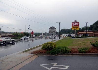
Photographed by Paul Crumlish, May 6, 2011
2. Wide view of the Boggan-Hammond House Marker

Photographed by Mark Parker, March 24, 2025
3. Boggan-Hammond House
Credits. This page was last revised on April 25, 2025. It was originally submitted on May 11, 2011, by PaulwC3 of Northern, Virginia. This page has been viewed 1,214 times since then and 35 times this year. Photos: 1, 2. submitted on May 11, 2011, by PaulwC3 of Northern, Virginia. 3. submitted on April 19, 2025, by Mark Parker of Hickory, North Carolina.
