Dobbs Ferry in Westchester County, New York — The American Northeast (Mid-Atlantic)
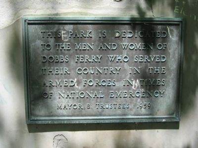
Dobbs Ferry Memorial Park
To The Men And Women Of
Dobbs Ferry Who Served
Their Country In The
Armed Forces In Tmes
Of National Emergency
Mayor & Trustees 1959
Erected 1959.
Topics. This memorial is listed in this topic list: Military.
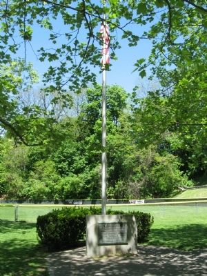
Location. 41° 0.825′ N, 73° 52.695′ W. Marker is in Dobbs Ferry, New York, in Westchester County. Memorial is on Palisade Street near Station Plaza, on the right when traveling south. Located in Memorial Park next to the baseball field. Touch for map. Marker is in this post office area: Dobbs Ferry NY 10522, United States of America. Touch for directions.
Other nearby markers. At least 8 other markers are within one mile of this marker, measured as the crow flies. Dobbs Ferry Veterans Memorial (about 300 feet away, measured in a direct line); Willow Point (approx. 0.2 miles away); Battle of Edgar's Lane (approx. 1.1 miles away); Squirrel Alley and River Place / El Callejon Squirrel y Riverview Place (approx. 1.1 miles away); Community Gardens in Zinsser Park / Los Jardines Comunitarios en el Parque Zinsser (approx. 1.1 miles away); The Tower Ridge Neighborhood / El Vecindario de la Torre Ridge (approx. 1.1 miles away); After the Battle (approx. 1.1 miles away); a different marker also named The Battle of Edgar's Lane (approx. 1.1 miles away). Touch for a list and map of all markers in Dobbs Ferry.
Credits. This page was last revised on January 8, 2020. It was originally submitted on May 15, 2011, by Michael Herrick of Southbury, Connecticut. This page has been viewed 620 times since then and 35 times this year. Photos: 1, 2, 3. submitted on May 15, 2011, by Michael Herrick of Southbury, Connecticut.


