Philomont in Loudoun County, Virginia — The American South (Mid-Atlantic)
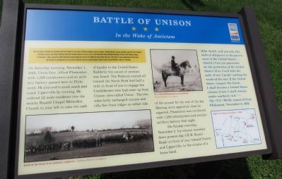
Battle of Unison
In the Wake of Antietam
After the Battle of Antietam in September 1862, Gen. Robert E. Lee's Army of Northern Virginia escaped to Virginia. President Abraham Lincoln repeatedly urged Union Gen. George B. McClellan to pursue and attack. Following a plan that Lincoln devised to trap Lee's army in the Shenandoah Valley, McClellan finally got his Army of the Potomac moving. On November 1, Union cavalry Gen. Alfred Pleasonton began leading the advance from Philomont toward Upperville. Gen. J.E.B. Stuart's cavalry delayed him for three days. On November 5, learning that Lee's army had evaded the trap and reached Culpeper County, Lincoln ordered McClellan relieved of command.
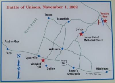
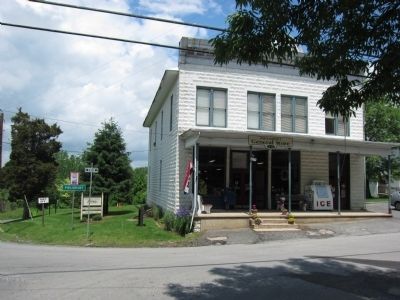
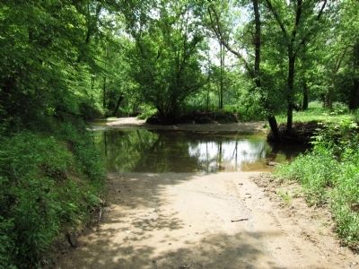
On Saturday morning, November 1, 1862, Union Gen. Alfred Pleasonton with 1,200 cavalrymen and an artillery battery paused here in Philomont. He planned to push south and reach Upperville by evening. He ordered 22 male residents into the nearby Roszell Chapel Methodist Church to your left to take the oath of loyalty to the United States. Suddenly the sound of cannons was heard. The Federals rushed off toward the North Fork ford half a mile in front of you to engage the Confederates who had come up from Unison (also called Union). The two sides hotly exchanged cannon and rifle fire from ridges on either side of the stream for the rest of the day. Meeting more opposition than he expected, Pleasonton was reinforced with 1,200 infantrymen and another artillery battery that night.
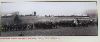
On Sunday morning, November 2, his column marched down present-day J.E.B. Stuart Road (in front of you) toward Unison and Uppervile, to the strains of a brass band.
"John Smith, will you take this oath of allegiance to the government of the United States? ...
[Smith:] Can you guarantee me the protection of the United States? If so, I will take the oath. If not, I prefer waiting the result of the war. If the United States conquer the South, I shall become a United States citizen; if not, I shall remain under southern rule."
- The (N.Y.) World, reported from Philomont, November 6, 1862
Erected 2011 by Virginia Civil War Trails.
Topics and series. This historical marker is listed in this topic list: War, US Civil. In addition, it is included in the Virginia Civil War Trails series list. A significant historical month for this entry is September 1862.
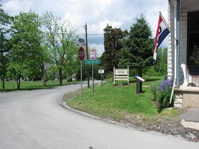
Location. 39° 3.39′ N, 77° 44.425′ W. Marker is in Philomont, Virginia, in Loudoun County. Marker is at the intersection of Snickersville Turnpike (County Route 734) and JEB Stuart Road (County Route 630), on the right when traveling north on Snickersville Turnpike. Touch for map. Marker is in this post office area: Philomont VA 20131, United States of America. Touch for directions.
Other nearby markers. At least 8 other markers are within 4 miles of this marker, measured as the crow flies. Round Oak Rag Apple Elevation (here, next to this marker); White Pump Drovers Tavern (approx. 1.4 miles away); Hibbs Bridge (approx. 1.6 miles away); Bacon Fort (approx. 2.2 miles away); a different marker also named The Battle of Unison (approx. 3.1 miles away); Bushrod Lynn (approx. 3.1 miles away); Huntland (approx. 3.2 miles away); a different marker also named Battle of Unison (approx. 3.2 miles away). Touch for a list and map of all markers in Philomont.
Credits. This page was last revised on June 16, 2016. It was originally submitted on May 16, 2011, by Craig Swain of Leesburg, Virginia. This page has been viewed 1,267 times since then and 35 times this year. Photos: 1, 2, 3, 4, 5, 6, 7. submitted on May 16, 2011, by Craig Swain of Leesburg, Virginia.
