Vandalia in Fayette County, Illinois — The American Midwest (Great Lakes)
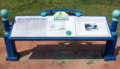
Lincoln Travels To The Capital
1834
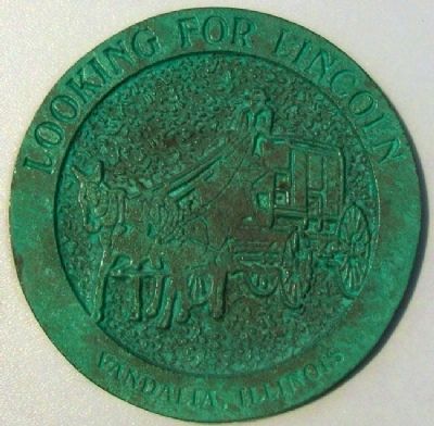
— Looking for Lincoln —
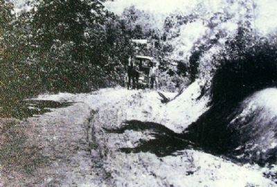
Abraham Lincoln traveled past this spot while he served as a state representative in Vandalia. This location marks the route of a road that ran from Vandalia to Springfield, Illinois. Traces of the roadway are still visible today. The roadway ran to the northwest and to the southeast from this location. An obvious depression is visible where the road ran. The growth-pattern of trees on either side also reflects the edge of the original roadway. Traffic on this road was steady but slow. Cumbersome wagons, riders on horseback, and the occasional pedestrian were common sights. There was little or no maintenance of such early roadways. Signage was virtually non-existent, as were roadside amenities, including inns, hotels, or stables. The traveler in this period was truly self-dependent. Lincoln once joked that the reason he wanted to move the capital from Vandalia to Springfield was to avoid traveling on this wearisome road.
On November 28, 1834 at 6:00 A.M., freshman Legislator Abraham Lincoln and five other members of the General Assembly from Sangamon County boarded the stagecoach in Springfield. The seventy-five-mile trip would take them to Vandalia via Macoupin Point and Hillsboro. The stagecoach arrived in Vandalia at 4:00 pm the next day. Travel at this time of year was generally a cold, muddy affair.
Roadways of the early 1800's were very primitive indeed. Some followed old animal trails. Almost all were simply dirt trails from which trees had been removed or cut off. In many instances, tree stumps remained in the roadway. They were cut at a height to allow a wagon to pass over them.
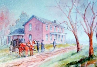
Pictured above is a painting of the building that served as a stop on the overland stage. The building still exists today, and it is located approximately four miles east of the city of Vandalia. This stagecoach stop was situated on the Cumberland Road at the intersection of the Vincennes Trace. While this place would not have been a stop for Abraham Lincoln, inns such as this one would have been located at intervals along the route that he traveled from Springfield to Vandalia.
Erected 2008 by Looking For Lincoln Heritage Coalition.
Topics and series. This historical marker is listed in these topic lists: Industry & Commerce • Roads & Vehicles • Settlements & Settlers. In addition, it is included in the Former U.S. Presidents: #16 Abraham Lincoln, and the Looking for Lincoln series lists. A significant historical month for this entry is November 1917.
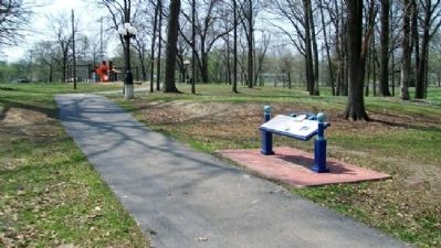
Location. 38° 58.297′ N, 89° 6.215′ W. Marker is in Vandalia, Illinois, in Fayette County. Marker is in Rogier Park, off West Fillmore Street. Touch for map. Marker is in this post office area: Vandalia IL 62471, United States of America. Touch for directions.
Other nearby markers. At least 8 other markers are within walking distance of this marker. Welcome to the National Road Interpretive Center (approx. 0.8 miles away); Ebenezer Capps' Store (approx. 0.8 miles away); Soldiers of the War for Independence Who Lived in Fayette County (approx. 0.8 miles away); Robert K. McLaughlin Home (approx. 0.9 miles away); Lincoln and the "Long Nine" (approx. 0.9 miles away); Vandalia (approx. 0.9 miles away); First Elective Office (approx. 0.9 miles away); House of Divine Worship (approx. 0.9 miles away). Touch for a list and map of all markers in Vandalia.
Also see . . .
1. Looking for Lincoln. National Heritage Area entry (Submitted on February 19, 2021, by Larry Gertner of New York, New York.)
2. National Road Interpretive Center. Vandalia IL Website entry (Submitted on May 17, 2011, by William Fischer, Jr. of Scranton, Pennsylvania.)
Credits. This page was last revised on February 19, 2021. It was originally submitted on May 17, 2011, by William Fischer, Jr. of Scranton, Pennsylvania. This page has been viewed 797 times since then and 30 times this year. Photos: 1, 2, 3, 4, 5. submitted on May 17, 2011, by William Fischer, Jr. of Scranton, Pennsylvania. 6. submitted on May 15, 2011, by William Fischer, Jr. of Scranton, Pennsylvania.
