Natchez in Adams County, Mississippi — The American South (East South Central)
DAR And The Natchez Trace
Inscription.
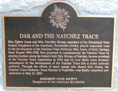
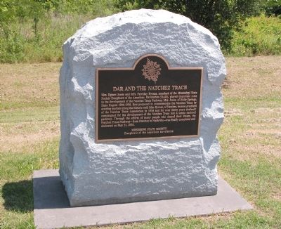
Mrs. Egbert Jones and Mrs. Ferriday Byrnes, members of the Mississippi State Society Daughters of the American Revolution (DAR), played important roles in the development of the Natchez Trace Parkway. Mrs. Jones, of Holly Springs, State Regent 1906 - 1908, first proposed to commemorate the Natchez Trace by erecting markers along the historic trail. Mrs. Byrnes, of Natchez, became president of the Natchez Trace Association in 1934 and for over thirty years tirelessly campaigned for the development of the Natchez Trace into a scenic national parkway. Through the efforts of many people who shared their dream, the Natchez Trace Parkway—from Natchez to Nashville—was finally completed and dedicated on May 21, 2005.
Erected by The Mississippi State Society, Daughters of the American Revolution.
Topics and series. This historical marker is listed in these topic lists: Communications • Roads & Vehicles • Settlements & Settlers. In addition, it is included in the Daughters of the American Revolution, and the Natchez Trace series lists. A significant historical month for this entry is May 1640.
Location. 31° 32.869′ N, 91° 21.919′ W. Marker is in Natchez, Mississippi, in Adams County. Marker is on Lissie Street/Old Cotton Street, ¼ mile north of Liberty Road, on the right when traveling north. This marker is located in a pull-off on Lissie St/Old Cotton St, which become the Natchez Trace Parkway. Touch for map. Marker is in this post office area: Natchez MS 39120, United States of America. Touch for directions.
Other nearby markers. At least 8 other markers are within 2 miles of this marker, measured as the crow flies. Origin of the Natchez Trace (a few steps from this marker); Forks of the Road Historical Site (approx. 1.2 miles away); Ex-"Slaves" as U.S. Civil War Soldiers in the Mississippi Valley Campaign (approx. 1.2 miles away); Forks of the Road (approx. 1.2 miles away); Natchez Chapter (approx. 1.3 miles away); a different marker also named Forks of the Road (approx. 1.3 miles away); Monmouth: Upstairs, Downstairs (approx. 1.3 miles away); History of St. Catherine Street (approx. 1.3 miles away). Touch for a list and map of all markers in Natchez.
Also see . . . Natchez Trace Parkway. National Park Service (Submitted on May 22, 2011, by Bernard Fisher of Richmond, Virginia.)
Credits. This page was last revised on June 16, 2016. It was originally submitted on May 22, 2011, by Karl Stelly of Gettysburg, Pennsylvania. This page has been viewed 1,794 times since then and 58 times this year. Photos: 1, 2. submitted on May 22, 2011, by Karl Stelly of Gettysburg, Pennsylvania. 3, 4. submitted on August 15, 2015, by Duane Hall of Abilene, Texas. • Bernard Fisher was the editor who published this page.


