Near Greensboro in Greene County, Georgia — The American South (South Atlantic)
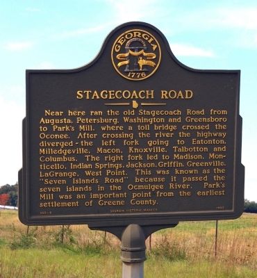
Stagecoach Road
Erected 1993 by Georgia Department of Natural Resources. (Marker Number 066-8.)
Topics and series. This historical marker is listed in these topic lists: Roads & Vehicles • Settlements & Settlers. In addition, it is included in the Georgia Historical Society series list.
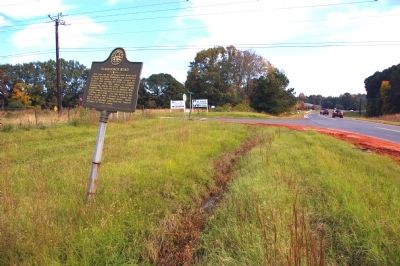
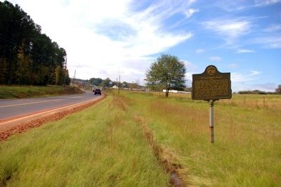
Location. 33° 33.2′ N, 83° 11.9′ W. Marker is near Greensboro, Georgia, in Greene County. Marker is at the intersection of Chipman Union Road (Georgia Route 44) and Willow Run Road, on the right when traveling south on Chipman Union Road. Touch for map. Marker is in this post office area: Greensboro GA 30642, United States of America. Touch for directions.
Other nearby markers. At least 8 other markers are within 2 miles of this marker, measured as the crow flies. Historic Springfield Baptist Church (approx. 1˝ miles away); Bishop George Foster Pierce (approx. 1.8 miles away); The Burning of Greensborough (approx. 1.8 miles away); Greene County (approx. 1.8 miles away); First Commissioner of Agriculture (approx. 1.9 miles away); William C. Dawson (approx. 1.9 miles away); Sheriff L. L. Wyatt (approx. 1.9 miles away); Old Greene County "Gaol" (approx. 1.9 miles away). Touch for a list and map of all markers in Greensboro.
More about this marker. This marker replaced an earlier marker of the same title and similar text near this location erected by the Georgia Historical Commission.
Credits. This page was last revised on January 30, 2020. It was originally submitted on November 2, 2009, by David Seibert of Sandy Springs, Georgia. This page has been viewed 1,677 times since then and 45 times this year. Last updated on May 26, 2011, by David Seibert of Sandy Springs, Georgia. Photos: 1, 2, 3. submitted on November 2, 2009, by David Seibert of Sandy Springs, Georgia. • Bill Pfingsten was the editor who published this page.


