Saint Anthony Main in Minneapolis in Hennepin County, Minnesota — The American Midwest (Upper Plains)
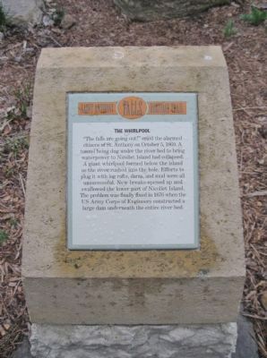
The Whirlpool
— Saint Anthony Falls Heritage Trail —
Erected by the St. Anthony Falls Heritage Board.
Topics. This historical marker is listed in this topic list: Disasters. A significant historical month for this entry is October 1848.
Location. 44° 59.083′ N, 93° 15.412′ W. Marker is in Minneapolis, Minnesota, in Hennepin County. It is in Saint Anthony Main. Marker can be reached from Southeast Main Street, 0.1 miles south of Merriam Street, on the right when traveling south. Marker is by a walking path near the east channel of the Mississippi River. Touch for map. Marker is in this post office area: Minneapolis MN 55414, United States of America. Touch for directions.
Other nearby markers. At least 8 other markers are within walking distance of this marker. Main Street Builds (about 300 feet away, measured in a direct line); Symbols on the Skyline (about 400 feet away); The Falls That Built the City (about 500 feet away); Follow the Water: Part 1 - Intake and Tunnel (about 500 feet away); A Horseshoe for the River (about 500 feet away); Eliza Winston (about 600 feet away); Electricity and Minneapolis (about 600 feet away); Harnessing Waterpower (about 600 feet away). Touch for a list and map of all markers in Minneapolis.
Also see . . . Saint Anthony Falls. Wikipedia entry. The 1869 collapse of the Hennepin Island tunnel. (Submitted on May 27, 2011.)
Credits. This page was last revised on February 12, 2023. It was originally submitted on May 27, 2011, by Keith L of Wisconsin Rapids, Wisconsin. This page has been viewed 912 times since then and 11 times this year. Photos: 1, 2. submitted on May 27, 2011, by Keith L of Wisconsin Rapids, Wisconsin.

