Arley in Winston County, Alabama — The American South (East South Central)
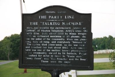
The Party Line - The “Talking Machine”
Historic Corner
Photographed by Tim & Renda Carr, May 29, 2011
1. The Party Line - The “Talking Machine” Marker
Erected 1978 by The Arley Community Historical Association.
Topics. This historical marker is listed in these topic lists: Communications • Entertainment. A significant historical year for this entry is 1909.
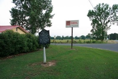
Location. 34° 3.848′ N, 87° 13.333′ W. Marker is in Arley, Alabama, in Winston County. It is at the intersection of County Route 41 and Mellville Road, on the right when traveling north on County Route 41. Touch for map. Marker is in this post office area: Arley AL 35541, United States
this page online

Regionally, this marker is in North Alabama. It is also in the American South, specifically in the Deep South, in Appalachia, and specifically in Southern Appalachia. Globally, it is in North America, a Gulf of Mexico state, the Western Hemisphere, the Western World, and the Anglosphere. Historically, it finds itself in what was once the territory of the Mississippian Culture, one of the Confederate States of America, and the Antebellum South.
Other nearby markers. At least 8 other markers are within 4 miles of this marker, measured as the crow flies: Old Arley School (about 500 feet away, measured in a direct line); History of Meek School (approx. 1.1 miles away); Arley, Alabama (approx. 1.2 miles away); Meek High School War Memorial (approx. 1.2 miles away); Piney Ridge School (approx. 1.9 miles away); Nathan, Alabama (approx. 1.9 miles away); Early Post Office Site (approx. 2 miles away); Brushy Creek (approx. 3.3 miles away). Touch for a list and map of all markers in Arley.
Photographed by Tim & Renda Carr, May 29, 2011
2. The Party Line - The “Talking Machine” Marker
Credits. This page was last revised on June 16, 2016. It was originally submitted on May 30, 2011, by Timothy Carr of Birmingham, Alabama. This page has been viewed 1,290 times since then and 43 times this year. Photos: 1, 2. submitted on May 30, 2011, by Timothy Carr of Birmingham, Alabama. • Bernard Fisher was the editor who published this page.
