Sedalia in Guilford County, North Carolina — The American South (South Atlantic)
Kimball Hall
Photographed by Paul Jordan, June 4, 2011
1. Kimball Hall Marker
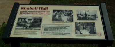
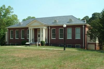
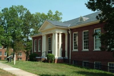
Kimball was the school's dining hall. Built in 1927, it honored the Kimball family of Massachusetts. In 1907, Helen F. Kimball purchased a 200-acre farm for the school's use.
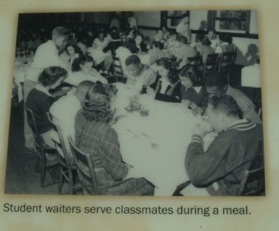
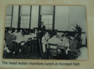
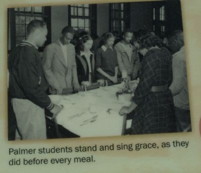
Palmer students learned and practiced proper dining etiquette during their meals. Any departure from acceptable table manners resulted in immediate disciplinary action and possible removal from the dining hall.
The basement of Kimball originally housed the industrial and mechanical arts classes.
Topics. This historical marker is listed in these topic lists: African Americans • Education • War, World II. A significant historical year for this entry is 1927.
Location. This marker has been replaced by another marker nearby. It was located near 36° 4.035′ N, 79° 37.327′ W. Marker was in Sedalia, North Carolina, in Guilford County. It could be reached from Burlington Road (U.S. 70) west of Palmer Farm Road. The marker is on the grounds of the Charlotte Hawkins Brown Historic Site. Touch for map. Marker was at or near this postal address: 6136 Burlington Road, Sedalia NC 27342, United States of America. Touch for directions.

Regionally, this
this page online
Other nearby markers. At least 8 other markers are within walking distance of this location: A different marker also named Kimball Hall (here, next to this marker); Galen Stone Dormitory & Massachusetts Congregational Cottage (within shouting distance of this marker); Science at Palmer & Stouffer Hall (within shouting distance of this marker); Devastating Fire (within shouting distance of this marker); Tea House (within shouting distance of this marker); Palmer Memorial Institute (within shouting distance of this marker); Athletics (within shouting distance of this marker); Alice Freeman Palmer Building (about 300 feet away, measured in a direct line). Touch for a list and map of all markers in
Photographed by Paul Jordan, June 4, 2011
2. Kimball Hall and Marker
Other markers no longer nearby. Galen L. Stone Hall 1927 (was within shouting distance of this marker but has been replaced with another marker now near it); Bell Tower (was within shouting distance of this marker but has been permanently removed).
Photographed by Paul Jordan, June 4, 2011
3. Kimball Hall
Photographed by Paul Jordan, June 4, 2011
4. Graduation Photo 1943
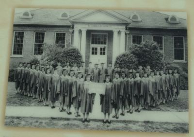
Each class took a graduation picture in front of Kimball Hall. Here, the class of 1943 poses in a "triangle of achievement" representing Palmer Memorial Institute's three goals: "Academically Efficient, Religiously Sincere, and Culturally Secure."
Photographed by Paul Jordan, June 4, 2011
5. Student waiters serve classmates during a meal.
Photographed by Paul Jordan, June 4, 2011
6. The head waiter monitors lunch in Kimball Hall.
Photographed by Paul Jordan, June 4, 2011
7. Students stand and sing grace, as they did before every meal.
Credits. This page was last revised on January 26, 2026. It was originally submitted on June 4, 2011, by Paul Jordan of Burlington, N. C., U. S. A.. This page has been viewed 1,306 times since then and 83 times this year. Photos: 1, 2, 3, 4, 5, 6, 7. submitted on June 4, 2011, by Paul Jordan of Burlington, N. C., U. S. A.. • Syd Whittle was the editor who published this page.
