Downtown Springfield in Greene County, Missouri — The American Midwest (Upper Plains)
St. Paul United Methodist Church
Photographed by William Fischer, Jr., February 12, 2011
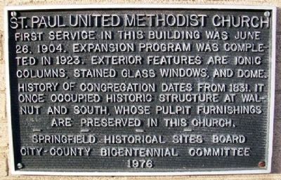
1. St. Paul United Methodist Church Marker
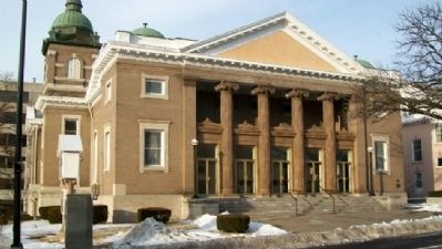
First service in this building was June 26, 1904. Expansion program was completed in 1923. Exterior features are Ionic columns, stained glass windows, and dome. History of congregation dates from 1831. It once occupied historic structure at Walnut and South, whose pulpit furnishings are preserved in this church.
Erected 1976 by Springfield Historical Sites Board and City-County Bicentennial Committee.
Topics. This historical marker is listed in these topic lists: Religion & Religious Structures • Settlements & Settlers. A significant historical month for this entry is June 1833.
Location. 37° 12.436′ N, 93° 17.37′ W. Marker is in Springfield, Missouri, in Greene County. It is in Downtown Springfield. It is on Walnut Street near Jefferson Avenue, on the left when traveling east. Touch for map. Marker is at or near this postal address: 413 East Walnut Street, Springfield MO 65806, United States of America. Touch for directions.

Regionally, this marker is in the American Ozarks, in the Lewis & Clark Corridor, and in the Corn Belt. Globally, it is in North America, the Western Hemisphere, the Western World, and the
this page online
Other nearby markers. At least 8 other markers are within walking distance of this marker: First Post Office in Springfield (within shouting distance of this marker); Keet-McElhany House (about 300 feet away, measured in a direct line); The Landers Theatre (about 400 feet away); Jewell Theater (about 600 feet away); 221 East Walnut Street (about 600 feet away); The Colonial Hotel (about 600 feet away); Rotary, Springfield, and the Birth of Route 66 (about 600 feet away); John T. Woodruff (about 700 feet away). Touch for a list and map of all markers in Springfield.
Also see . . . St. Paul United Methodist Church. Church website homepage (Submitted on June 5, 2011, by William Fischer, Jr. of Reynoldsburg, Ohio.)
Photographed by William Fischer, Jr., February 12, 2011
2. St. Paul United Methodist Church and Marker
Marker on far right side of church.
Photographed by William Fischer, Jr., February 12, 2011
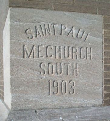
3. St. Paul United Methodist Church Cornerstone
Photographed by William Fischer, Jr., February 12, 2011
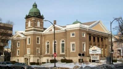
4. St. Paul United Methodist Church
Looking northeast
Credits. This page was last revised on February 16, 2023. It was originally submitted on June 5, 2011, by William Fischer, Jr. of Reynoldsburg, Ohio. This page has been viewed 1,313 times since then and 41 times this year. Photos: 1, 2, 3, 4. submitted on June 5, 2011, by William Fischer, Jr. of Reynoldsburg, Ohio.
