Alkali Flat in Sacramento in Sacramento County, California — The American West (Pacific Coastal)
Site of First African Methodist Episcopal Church on the Pacific Coast
Inscription.
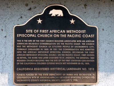
This is the site of the first church building associated with an African American religious congregation on the Pacific Coast. The church was the Methodist Church of Colored People of Sacramento City, formally organized in 1850. In 1851 the congregation was admitted into the African Methodist Episcopal Church, becoming the first African Methodist Episcopal Church on the Pacific Coast. First known as Bethel, the name was later changed to St. Andrews. The original 1850 wooden church building was the site of the first statewide convention of the California Colored Citizens which met November 20-22, 1855.
California Registered Historical Landmark No. 1013
Plaque placed by the State Department of Parks and Recreation in cooperation with St. Andrews African Methodist Episcopal Church and Sacramento County Historical Society, January 7, 1995.
Erected 1995 by State Department of Parks and Recreation in cooperation with St. Andrews African Methodist Episcopal Church and Sacramento County Historical Society. (Marker Number 1013.)
Topics and series. This historical marker is listed in these topic lists: African Americans • Churches & Religion. In addition, it is included in the African Methodist Episcopal (AME) Church, and the California Historical Landmarks series lists. A significant historical date for this entry is January 7, 1864.
Location. 38° 35.053′ N, 121° 29.762′ W. Marker is in Sacramento, California, in Sacramento County. It is in Alkali Flat. Marker is on Seventh Street, on the left when traveling south. Touch for map. Marker is at or near this postal address: 715 Seventh Street, Sacramento CA 95814, United States of America. Touch for directions.
Other nearby markers. At least 8 other markers are within walking distance of this marker. Old Folsom Powerhouse (about 500 feet away, measured in a direct line); Site of First and Second State Capitols at Sacramento (about 700 feet away); United States Post Office, Courthouse, & Federal Building (about 800 feet away); Williams House (approx. 0.2 miles away); Sa’ Cumn’e Plaza (approx. 0.2 miles away); Pioneer Hall (approx. ¼ mile away); Sacramento Pioneers Society (approx. ¼ mile away); A.J. Stevens Monument (approx. ¼ mile away). Touch for a list and map of all markers in Sacramento.
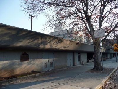
More about this marker. Marker is attached to the side of a public parking garage structure.
Credits. This page was last revised on February 7, 2023. It was originally submitted on December 21, 2007, by Karen Key of Sacramento, California. This page has been viewed 2,048 times since then and 37 times this year. Photos: 1, 2. submitted on December 21, 2007, by Karen Key of Sacramento, California.

