North Olmsted in Cuyahoga County, Ohio — The American Midwest (Great Lakes)
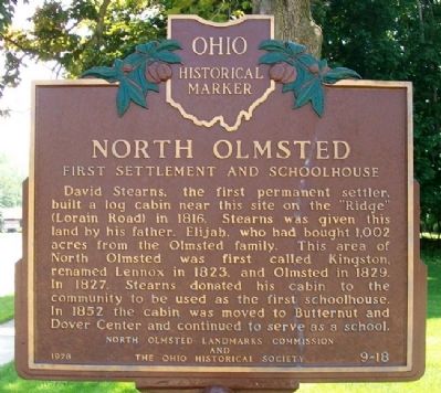
North Olmsted
First Settlement and Schoolhouse
David Stearns, the first permanent settler, built a log cabin near this site on the "Ridge" (Lorain Road) in 1816. Stearns was given this land by his father, Elijah, who had bought 1,002 acres from the Olmsted family. This area of North Olmsted was first called Kingston, renamed Lennox in 1823, and Olmsted in 1829. In 1827, Stearns donated his cabin to the community to be used as the first schoolhouse. In 1852 the cabin was moved to Butternut and Dover Center and continued to serve as a school.
Erected 1978 by North Olmsted Landmarks Commission and The Ohio Historical Society. (Marker Number 9-18.)
Topics and series. This historical marker is listed in these topic lists: Education • Settlements & Settlers. In addition, it is included in the Ohio Historical Society / The Ohio History Connection series list. A significant historical year for this entry is 1816.
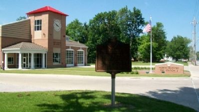
Location. 41° 24.283′ N, 81° 56.9′ W. Marker is in North Olmsted, Ohio, in Cuyahoga County. Marker is at the intersection of Lorain Road (Ohio Route 10) and Christman Drive, on the right when traveling west on Lorain Road. Marker is adjacent to North Olmsted Fire Station 2. Touch for map. Marker is at or near this postal address: 29592 Lorain Road, North Olmsted OH 44070, United States of America. Touch for directions.
Other nearby markers. At least 8 other markers are within 3 miles of this marker, measured as the crow flies. North Olmsted Veterans Plaza (approx. 0.9 miles away); The Oxcart Library (approx. 1.3 miles away); First Universalist Church (approx. 1.3 miles away); Leverett Johnson / Evergreen Cemetery (approx. 1.8 miles away); Springvale Ballroom (approx. 1.9 miles away); Olmsted’s Origins / Olmsted Township (approx. 2 miles away); Butternut Ridge Cemetery 1835 (approx. 2.2 miles away); The Weston House / Sandstone Houses (approx. 2.9 miles away). Touch for a list and map of all markers in North Olmsted.
Also see . . . About North Olmsted. City website entry (Submitted on June 12, 2011, by William Fischer, Jr. of Scranton, Pennsylvania.)
Credits. This page was last revised on March 27, 2024. It was originally submitted on June 12, 2011, by William Fischer, Jr. of Scranton, Pennsylvania. This page has been viewed 896 times since then and 79 times this year. Photos: 1, 2. submitted on June 12, 2011, by William Fischer, Jr. of Scranton, Pennsylvania.

