Fort Chiswell in Wythe County, Virginia — The American South (Mid-Atlantic)
Lead Mines
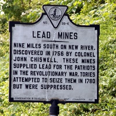
Photographed by J. J. Prats, May 28, 2011
1. Lead Mines Marker
Erected 1927 by Conservation & Development Commission. (Marker Number K-39.)
Topics and series. This historical marker is listed in these topic lists: Industry & Commerce • War, US Revolutionary. In addition, it is included in the Virginia Department of Historic Resources (DHR) series list. A significant historical year for this entry is 1756.
Location. This marker has been replaced by another marker nearby. It was located near 36° 56.658′ N, 80° 56.859′ W. Marker was in Fort Chiswell, Virginia, in Wythe County. It was at the intersection of U.S. 52 and Exit 80 (Interstate 81), on the right when traveling south on U.S. 52. Touch for map. Marker was in this post office area: Max Meadows VA 24360, United States of America. Touch for directions.

Regionally, this marker was in Southwest Virginia and in the Blue Ridge Highlands. It was also in the American South, specifically in the Upper South, in Appalachia,
this page online
Other nearby markers. At least 8 other markers are within 7 miles of this location, measured as the crow flies: Anchor and Hope Plantation (a few steps from this marker); a different marker also named Lead Mines (within shouting distance of this marker); Fort Chiswell (approx. 0.8 miles away); Wilderness Road (approx. 0.8 miles away); Fincastle County (approx. 4.8 miles away); Wythe County Poorhouse Farm (approx. 5.1 miles away); New River (approx. 6.1 miles away); To Mark The Site of The Lead Mines (approx. 6.2 miles away). Touch for a list and map of all markers in Fort Chiswell.
More about this marker. This marker was originally erected on U.S. Route 11, which has been replaced through these parts by Interstate 81.
Regarding Lead Mines. The nearby Jackson Ferry Shot Tower used to
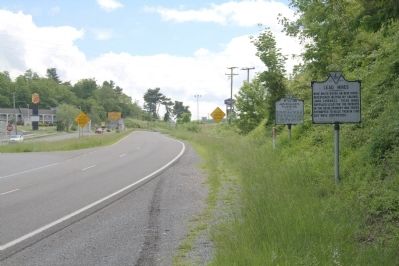
Photographed by J. J. Prats, May 28, 2011
2. Lead Mines, and Anchor and Hope Plantation Markers
Also see . . . Wikipedia entry for Withe County. “Lead was mined and shipped throughout the fledgling country; lead shot was also produced. Located near Fosters Falls, Jackson Ferry Shot Tower still stands as a testament to the citizens of Wythe County. Lead was hoisted to the top of the tower using block and tackle and oxen. The lead was melted in a retort and then poured through a sieve at the top of the tower. The droplets of molten lead would become round during the 150-foot descent. The shot would collect in a kettle of water and workers would enter through a 110-foot access tunnel located near the bank of the New River to retrieve the shot from the kettle.
“The lead mines closed in 1982 due to new United States Environmental Protection Agency standards and the lack of market for lead. The mines have since filled with water; the main shaft extended in excess of 1100 feet straight down. ... The community was named for Colonel John Chiswell who helped establish the lead mines (1757).” (Submitted on June 12, 2011.)
Credits. This page was last revised on July 10, 2026. It was originally submitted on June 12, 2011, by J. J. Prats of Powell, Ohio. This page has been viewed 4,290 times since then and 153 times this year. Photos: 1, 2. submitted on June 12, 2011, by J. J. Prats of Powell, Ohio.
