Walterboro in Colleton County, South Carolina — The American South (South Atlantic)
Training the Tuskegee Airmen
Photographed by Mike Stroud, May 22, 2011
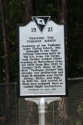
1. Training the Tuskegee Airmen Marker
Graduates of the Tuskegee Army Flying School, who belonged to the first African-American units in the U.S. Army Air Corps, took further combat flight training at Walterboro Army Air Field from May 1944 to October 1945. Many of the first “Tuskegee Airmen” had already won distinction and fame in missions over North Africa, Sicily, and Italy in 1943-44, and several of them were assigned here as combat flight instructors.
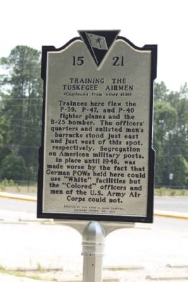
(Reverse text)
Trainees here flew the P-39, P-47, and P-40 fighter planes and the B-25 bomber. The officers’ quarters and enlisted men’s barracks stood just east and just west of this spot, respectively. Segregation on American military posts, in place until 1948, was made worse by the fact that German POWs held here could use “White” facilities but the “Colored” officers and men of the U.S. Army Air Corps could not.
Erected 2011 by The Hiram E. Mann Chapter, Tuskegee Airmen, Inc. (Marker Number 15-21.)
Topics and series. This historical marker is listed in these topic lists: African Americans • War, World II. In addition, it is included in the Tuskegee Airmen series list. A significant historical month for this entry is May 1944.
Location. 32° 56.376′ N, 80° 38.162′ W. Marker is in Walterboro, South Carolina, in Colleton County. It is on Mighty Cougar Drive. Located near the Colleton County High School eastside Student Parking Lot. Touch for map. Marker is at or near this postal address: 1447 Mighty Cougar Drive, Walterboro SC 29488, United States of America. Touch for directions.

Regionally, this marker is in South Carolina’s Lowcountry, in the Ashepoo and Combahee and Edisto Basin. It is also in the American South, specifically in the Deep South, and on the Eastern Seaboard. Globally, it is in the North Atlantic Region,
this page online
Other nearby markers. At least 8 other markers are within 2 miles of this marker, measured as the crow flies: Prisoner Of War Camp and Camouflage School (approx. 1.6 miles away); Walterboro Army Air Field (approx. 1.6 miles away); The Tuskegee Airman of World War II (approx. 1.6 miles away); Walterboro Army Airfield (approx. 1.6 miles away); The Tuskegee Airmen (approx. 1.6 miles away); The Beacon (approx. 1.6 miles away); a different marker also named Walterboro Army Airfield (approx. 1.6 miles away); Anderson Field / Walterboro Army Air Field (approx. 1.6 miles away). Touch for a list and map of all markers in Walterboro.
Photographed by Mike Stroud, May 22, 2011
2. Training the Tuskegee Airmen Marker, reverse side
Photographed by Mike Stroud, May 22, 2011
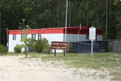
3. Training the Tuskegee Airmen Marker
Photographed by Mike Stroud, May 22, 2011
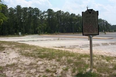
4. Training the Tuskegee Airmen Marker, as seen near Mighty Cougar Drive
next to the Colleton County High School eastside Student Parking Lot
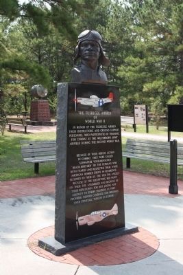
Photographed by Mike Stroud, September 13, 2009
5. Tuskegee Airmen Memorial
* See Nearby Markers for more information about Tuskegee Airmen
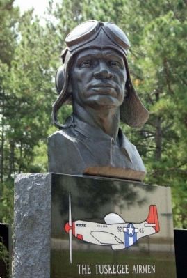
Photographed by Mike Stroud, September 13, 2009
6. Tuskegee Airmen Memorial
Credits. This page was last revised on November 15, 2020. It was originally submitted on June 14, 2011, by Mike Stroud of Bluffton, South Carolina. This page has been viewed 762 times since then and 26 times this year. Photos: 1, 2, 3, 4. submitted on June 20, 2011, by Mike Stroud of Bluffton, South Carolina. 5, 6. submitted on June 14, 2011, by Mike Stroud of Bluffton, South Carolina.
