
Winton in Hertford County, North Carolina — The American South (South Atlantic)
Burning of Winton
"Fire… accompanied the sword"
| — | Coastal Expeditions | — |
Photographed by Dave Twamley, July 17, 2010
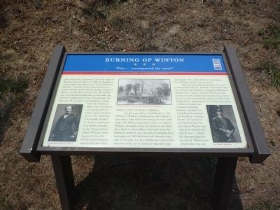
1. Burning of Winton Marker
After Union Gen. Ambrose E. Burnside captured Roanoke Island in February 1862, he decided to "sweep Albemarle Sound clean of [Confederate] defenses," establish inland bases of operation, and encourage eastern North Carolina Unionists. Winton, the Hertford County seat, was located near two railroad bridges and, as Burnside was informed, packed with Union sympathizers. On February 18, he issued a proclamation stating that "the Northern people were Christians and would inflict no injury unless forced to do so." The same day, Commander Stephen C. Rowan's eight-gun-boat flotilla steamed up the Chowan River toward Winton, carrying part of the 4th Rhode Island Infantry and the 9th New York Infantry under Col. Rush C. Hawkins.
As they approached, Confederate Lt. Col. William T. Williams concealed his 400 infantrymen atop a high bluff overlooking the river, with Capt. J.N. Nichols's four-gun battery in support. Williams planned to lure the flotilla to the dock, then blast it with artillery and small-arms fire. Hawkins, however, saw the glint of muskets from the rigging of the USS Delaware and shouted warnings to the pilot.
this page online
The next morning, the gunboats returned and bombarded Winton. Williams, his soldiers, and the residents fled. Hawkins, enraged by Williams's ambush tactic, led his men into Winton to loot and set the town ablaze with barrels of tar, burning the courthouse with the county records. Only the Methodist church and two buildings belonging to Union sympathizers remained standing. Hawkins claimed that Confederates had used the buildings "as storehouses and quarters" and boasted that the burning of Winton was "the first instance during the war... where fire has accompanied the sword." Winton was rebuilt after the war.
Erected by North Carolina Civil War Trails.
Topics and series. This historical marker is listed in this topic list: War, US Civil. In addition, it is included in the North Carolina Civil War Trails series list. A significant historical month for this entry is February 1862.
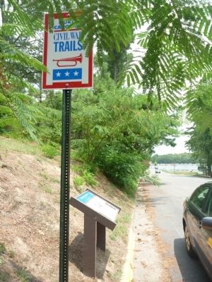
Location. This marker has been replaced by another marker nearby. It was located near 36° 23.878′ N, 76° 55.953′ W.
Photographed by Dave Twamley, July 17, 2010
2. Burning of Winton Marker

Regionally, this marker was in North Carolina’s Coastal Plain. It was also in the American South, specifically in the Upper South, in the Tidewater, and on the Eastern Seaboard. Globally, it was in the North Atlantic Region, North America, the Western Hemisphere, the Western World, and the Anglosphere. Historically, it found itself in what was once the territory of the Mississippian Culture, one of the original Thirteen Colonies, one of the Confederate States of America, and the Antebellum South.
Other nearby markers. At least 8 other markers are within 3 miles of this location, measured as the crow flies: Hertford County WWI Memorial (about 400 feet away, measured in a direct line); a different marker also named Burning of Winton (about 500 feet away); a different marker also named Burning of Winton (about 500 feet away); Hertford County UDC Monument (about 600 feet away); Early Exploration (approx. half a mile away); Chowan Academy (approx. 0.9 miles away); Meherrin Town (approx. 1.4 miles away); Lemuel W. Boone (approx. 2½ miles away). Touch for a list and map of all markers in Winton.
Credits. This page was last revised on June 23, 2025. It was originally submitted on June 15, 2011, by Dave Simpson of Durham, North Carolina. This page has been viewed 1,826 times since then and 33 times this year. Photos: 1, 2. submitted on June 15, 2011, by Dave Simpson of Durham, North Carolina. • Craig Swain was the editor who published this page.
