Near Nokesville in Prince William County, Virginia — The American South (Mid-Atlantic)
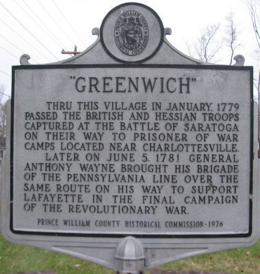
“Greenwich”
Later on June 5, 1781 General Anthony Wayne brought his brigade of the Pennsylvania Line over the same route on his way to support Lafayette in the final campaign of the Revolutionary War.
Erected 1976 by Prince William County Historical Commission. (Marker Number 37.)
Topics and series. This historical marker is listed in this topic list: War, US Revolutionary. In addition, it is included in the Virginia, Prince William County Historical Commission series list. A significant historical month for this entry is January 1779.
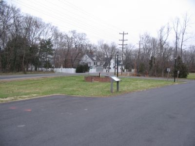
Location. 38° 45.006′ N, 77° 38.871′ W. Marker is near Nokesville, Virginia, in Prince William County. Marker is at the intersection of Vlint Hill Road (State Road 215) and Burwell Road (County Route 604), on the right when traveling south on Vlint Hill Road. Located in front of the Greenwich Presbyterian Church. Touch for map. Marker is in this post office area: Nokesville VA 20181, United States of America. Touch for directions.
Other nearby markers. At least 8 other markers are within 3 miles of this marker, measured as the crow flies. Stony Lonesome Farm (here, next to this marker); a different marker also named Greenwich (a few steps from this marker); Vint Hill Farms Station (approx. 1.6 miles away); Grapewood Farm Engagement (approx. 2.2 miles away); Buckland (approx. 2.6 miles away); The Buckland Mill (approx. 2.6 miles away); Buckland Mills Battle (approx. 2.6 miles away); Battle of Buckland Mills (approx. 2.6 miles away).
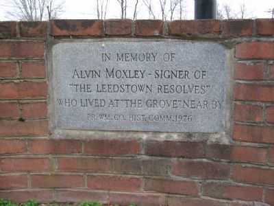
Also see . . . Leedstown or Westmoreland Resolves. The resolution referenced on one of the side panels was a protest against the Stamp Act in 1766. Signed by planters from several Virginia counties, this document was written by Richard Henry Lee, was one of the first steps which eventually led to the Declaration of Independence some ten years later. (Submitted on December 23, 2007, by Craig Swain of Leesburg, Virginia.)
Credits. This page was last revised on June 16, 2016. It was originally submitted on December 23, 2007, by Craig Swain of Leesburg, Virginia. This page has been viewed 1,952 times since then and 41 times this year. Photos: 1, 2, 3, 4. submitted on December 23, 2007, by Craig Swain of Leesburg, Virginia.


