Near Helen in White County, Georgia — The American South (South Atlantic)
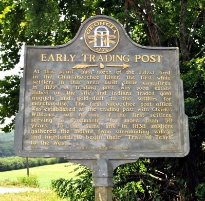
Early Trading Post
→
Erected 1955 by Georgia Historical Commission. (Marker Number 154-6.)
Topics and series. This historical marker is listed in these topic lists: Industry & Commerce • Native Americans • Settlements & Settlers. In addition, it is included in the Georgia Historical Society, and the Trail of Tears series lists. A significant historical year for this entry is 1822.
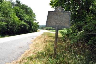
Location. 34° 40.876′ N, 83° 41.95′ W. Marker is near Helen, Georgia, in White County. Marker is on Unicoi Turnpike (Georgia Route 17) 0.7 miles east of Helen Highway (Georgia Route 75), on the right when traveling east. Touch for map. Marker is in this post office area: Helen GA 30545, United States of America. Touch for directions.
Other nearby markers. At least 8 other markers are within walking distance of this marker. Nacoochee Valley (about 300 feet away, measured in a direct line); The Game Room (approx. 0.6 miles away); Fountain and Greenhouse (approx. 0.6 miles away); The Residence at West End (approx. 0.6 miles away); Nacoochee Indian Mound (approx. 0.6 miles away); Spring and Gas House (approx. 0.6 miles away); The Carriage House (approx. 0.6 miles away); Hardman's Dairy Barn (approx. 0.6 miles away). Touch for a list and map of all markers in Helen.
Credits. This page was last revised on June 16, 2016. It was originally submitted on June 23, 2011, by David Seibert of Sandy Springs, Georgia. This page has been viewed 1,034 times since then and 47 times this year. Photos: 1, 2. submitted on June 23, 2011, by David Seibert of Sandy Springs, Georgia. • Bill Pfingsten was the editor who published this page.

