Rhodesdale in Dorchester County, Maryland — The American Northeast (Mid-Atlantic)
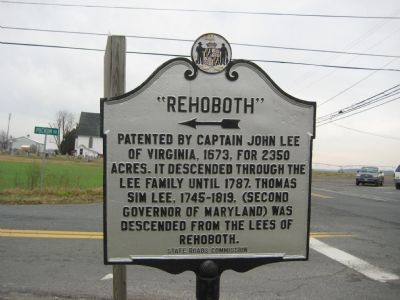
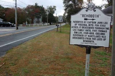
"Rehoboth"
Erected by State Roads Commission.
Topics. This historical marker is listed in these topic lists: Colonial Era • Government & Politics • Settlements & Settlers. A significant historical year for this entry is 1673.
Location. 38° 35.051′ N, 75° 47.316′ W. Marker is in Rhodesdale, Maryland, in Dorchester County. Marker is at the intersection of Rhodesdale Eldorado Road (Maryland Route 14) and Puckam Road (County Highway 282), on the left when traveling north on Rhodesdale Eldorado Road. Touch for map. Marker is at or near this postal address: 5752 Eldorado Rd, Rhodesdale MD 21659, United States of America. Touch for directions.
Other nearby markers. At least 8 other markers are within 6 miles of this marker, measured as the crow flies. Chesapeake Bay Restoration in Progress (approx. 4.7 miles away); Sharptown War Memorial (approx. 4.8 miles away); Veterans Memorial (approx. 5 miles away); The African American Story in the Indian Town (approx. 5.4 miles away); The native people of the Chicacone Village…the Nanticokes (approx. 5.4 miles away); Handsell (approx. 5.4 miles away); The Nanticoke Historic Preservation Alliance (approx. 5.4 miles away); San Domingo School (approx. 5˝ miles away).
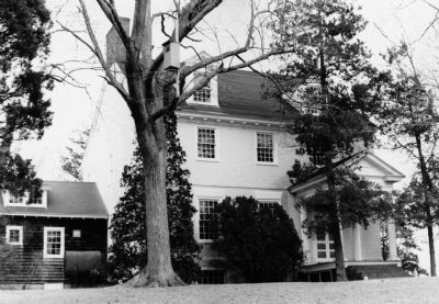
Regarding "Rehoboth". From the Maryland Historical Trust: "The association of Rehoboth with Richard Henry Lee and Francis Lightfoot Lee, each a Signer of the Declaration of Independence, as well as the interstate relationship between the Lees of Virginia and the Lees of Maryland, brings this house into significant historical focus. Descending through the family of the second elected Governor of Maryland, Thomas Sim Lee, adds to its historical value. The house is also significant for its architecture."
Also see . . .
1. Rehoboth. Maryland's National Register Properties entry (Submitted on December 30, 2020, by Larry Gertner of New York, New York.)
2. Rehoboth, (Liberty Hall, Turpin Place, Lee Mansion). Maryland Historical Trust Architectural Survey File PDF (Submitted on December 30, 2020, by Larry Gertner of New York, New York.)
Credits. This page was last revised on August 31, 2022. It was originally submitted on December 26, 2007, by F. Robby of Baltimore, Maryland. This page has been viewed 1,356 times since then and 38 times this year. Photos: 1. submitted on December 26, 2007, by F. Robby of Baltimore, Maryland. 2. submitted on October 24, 2012, by Mike Stroud of Bluffton, South Carolina. 3. submitted on December 26, 2007, by F. Robby of Baltimore, Maryland.


