Downieville in Sierra County, California — The American West (Pacific Coastal)
Sierra County, California
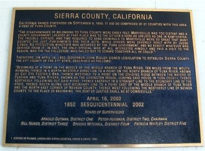
“The disadvantages of belonging to Yuba County were early felt; Marysville was too distant and a county government located at that place was to the citizen’s here as useless as one in Kamtchatka. The trouble, expense and the time required to send criminals to Marysville were so great that many escaped the punishments for their acts, while others were severely dealt with by Judge Lynch. No protection whatever was afforded by the Yuba government, and no benefit whatever was derived from it; in fact, the only official who at all interested himself and paid a visit to the region, was the tax collector, who failed not to scrape together all he could.”
Therefore, on April 16, 1852, Governor John Bigler signed legislation to establish Sierra County, the 31st county of the 31st state, described as follows:
“Beginning at a point in the middle of the middle branch of Yuba River, ten miles from the mouth, running thence in a north-westerly direction to a point of the north branch of Yuba River, known as Cut Eye Foster’s Bar, thence westerly to a point on dividing ridge between the waters of Feather and Yuba Rivers, known as the Lexington House, leaving said house in Yuba County, thence northerly, following out said ridge; thence easterly in a straight line to the boundary line of the state; thence south along said boundary line to a point east of the middle branch of Yuba River and north-east corner of Nevada County; thence west following the northerly line of Nevada County; to the place beginning. The seat of justice shall be at Downieville.”
1852 Sesquicentennial 2002
Board of Supervisors
History of Plumas, Lassen and Sierra Counties, Pariss & Smith, 1882
Erected 2002 by County Board of Supervisors, Sierra County.
Topics. This historical marker is listed in this topic list: Government & Politics. A significant historical date for this entry is April 16, 1852.
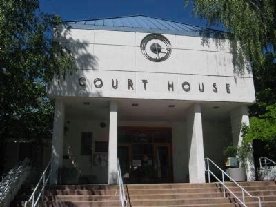
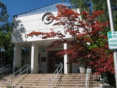
Location. 39° 33.536′ N, 120° 49.808′ W. Marker is in Downieville, California, in Sierra County. Marker can be reached from Courthouse Square near Galloway Street. Touch for map. Marker is at or near this postal address: 100 Courthouse Square, Downieville CA 95936, United States of America. Touch for directions.
Other nearby markers. At least 8 other markers are within walking distance of this marker. Mountain Howitzers (here, next to this marker); Sierra County Sheriff’s Gallows (a few steps from this marker); Henness Pass Road - Downieville (about 500 feet away, measured in a direct line); Hirshfeldter Building (about 700 feet away); Masonic Building (about 700 feet away); Downieville Veterans Memorial (about 700 feet away); In Memory of Juanita (about 700 feet away); Craycroft Building (about 800 feet away). Touch for a list and map of all markers in Downieville.
Also see . . . Sierra County History. Sierra County Gold entry:
The county was once home to both the Maidu and Washoe Indians, but today’s history is tied to the Gold Rush. The discovery of gold resulted in some 16,000 miners settling the county between 1848 and 1860. (Submitted on June 27, 2011.)
Photographed By Syd Whittle, June 27, 2011
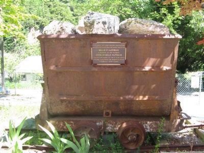
5. Mine Car on Display on the Courthouse Grounds
Nellie P. Huffman
In memory of her husband
Vernon Wills Huffman
A resident of Downieville for 47 years with a lifelong involvement and interests in mining throughout Sierra County
Credits. This page was last revised on January 26, 2021. It was originally submitted on June 27, 2011, by Syd Whittle of Mesa, Arizona. This page has been viewed 795 times since then and 16 times this year. Photos: 1, 2, 3, 4, 5. submitted on June 27, 2011, by Syd Whittle of Mesa, Arizona. 6, 7. submitted on June 27, 2011. 8. submitted on June 27, 2011, by Syd Whittle of Mesa, Arizona.
